Ljusdal geodata
Ljusdal (Gävleborg) is a seat of a second-order administrative division; located in Sweden in Europe/Stockholm (GMT+2) time zone. With population of 7,259 people, there are 202 cities with bigger population in this country. Compared to other cities in Sweden, 85% of cities are located further ↓South; 62.8% of cities are located further ←West and 77.7% of cities have lower elevation than Ljusdal. Note1


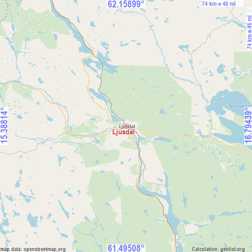
Ljusdal GPS coordinates[2]
61° 49' 43.788" North, 16° 5' 28.536" East
| Map corner | latitude | longitude |
|---|---|---|
| Upper-left | 62.15899°, | 15.38814° |
| Center: | 61.82883°, | 16.09126° |
| Lower-right: | 61.49508°, | 16.79439° |
| Map W x H: | 73.8×73.8 km | = 45.9×45.9mi |
| max Lat: | 67.85572° ⇑15% North |
| Ljusdal: | 61.82883° |
| min Lat: | ⇓85% South 55.34337° |
| min Long | Ljusdal | max Long |
| 11.1712° | 16.09126° | 24.13676° |
| W 62.8%⇐ | ⇒37.2% E |
Elevation
Elevation of Ljusdal is 132 m = 433 ft, and this is 49.4 m = 162 ft above average elevation for this country.
| Max E: |
663 m = 2175 ft | 22.3% |
| Ljusdal | 132 m 433 ft | |
| Avg. | 82.6 m = 271 ft | |
Min E: |
-1 m = -3 ft | 77.7% |
See also: Sweden elevation on elevation.city.
Geographical zone
Ljusdal is located in North temperate zone (between Tropic of Cancer and the Arctic Circle). Distance of this North polar circle is 526.5 km =327.2 mi to North.| Distance of | km | miles | from Ljusdal |
|---|---|---|---|
| North Pole | 3132.3 | 1946.3 | to North |
| Arctic Circle | 526.5 | 327.2 | to North |
| Tropic Cancer | 4268.8 | 2652.5 | to South |
| Equator | 6874.7 | 4271.7 | to South |


Nearby cities:
15 places around Ljusdal: (largest is in red/bold)
• Alfta
53.6 km =33.3 mi,  180°
180°
• Arbrå
43.1 km =26.8 mi,  159°
159°
• Bergsjö
53.7 km =33.4 mi,  71°
71°
• Bollnäs
55.8 km =34.7 mi, 163°
• Delsbo
24.6 km =15.3 mi,  97°
97°
• Edsbyn
52.3 km =32.5 mi,  196°
196°
• Friggesund
25.1 km =15.6 mi, 72°
• Färila
13.4 km =8.3 mi,  256°
256°
• Hudiksvall
54.5 km =33.9 mi, 101°
• Iggesund
55.8 km =34.7 mi,  111°
111°
• Järvsö
13.1 km =8.1 mi, 162°
• Njutånger
56.2 km =34.9 mi,  115°
115°
• Näsviken
41.3 km =25.7 mi, 99°
• Sörforsa
48.1 km =29.9 mi, 102°
• Tallåsen
5.7 km =3.5 mi,  317°
317°
Sources, notices
• [Note1] Compared only with cities in Sweden existing in our database
• [Src1] Map data: © OpenStreetMap contributors (CC-BY-SA)
• [Src2] Other city data from geonames.org with taken over terms of usage.
• [Src3] Geographical zone / Annual Mean Temperature by Robert A. Rohde @ Wikipedia
