Tallåsen geodata
Tallåsen (Gävleborg) is a populated place; located in Sweden in Europe/Stockholm (GMT+2) time zone. With population of 586 people, there are 1191 cities with bigger population in this country. Compared to other cities in Sweden, 85.2% of cities are located further ↓South; 62% of cities are located further ←West and 89.7% of cities have lower elevation than Tallåsen. Note1


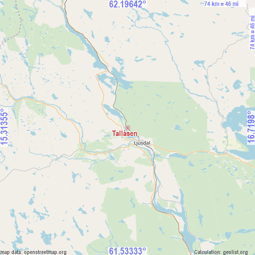
Tallåsen GPS coordinates[2]
61° 52' 0.012" North, 16° 1' 0.012" East
| Map corner | latitude | longitude |
|---|---|---|
| Upper-left | 62.19642°, | 15.31355° |
| Center: | 61.86667°, | 16.01667° |
| Lower-right: | 61.53333°, | 16.7198° |
| Map W x H: | 73.7×73.7 km | = 45.8×45.8mi |
| max Lat: | 67.85572° ⇑14.8% North |
| Tallåsen: | 61.86667° |
| min Lat: | ⇓85.2% South 55.34337° |
| min Long | Tallåsen | max Long |
| 11.1712° | 16.01667° | 24.13676° |
| W 62%⇐ | ⇒38% E |
Elevation
Elevation of Tallåsen is 199 m = 653 ft, and this is 116.4 m = 382 ft above average elevation for this country.
| Max E: |
663 m = 2175 ft | 10.3% |
| Tallåsen | 199 m 653 ft | |
| Avg. | 82.6 m = 271 ft | |
Min E: |
-1 m = -3 ft | 89.7% |
See also: Sweden elevation on elevation.city.
Geographical zone
Tallåsen is located in North temperate zone (between Tropic of Cancer and the Arctic Circle). Distance of this North polar circle is 522.2 km =324.5 mi to North.| Distance of | km | miles | from Tallåsen |
|---|---|---|---|
| North Pole | 3128.1 | 1943.7 | to North |
| Arctic Circle | 522.2 | 324.5 | to North |
| Tropic Cancer | 4273 | 2655.1 | to South |
| Equator | 6878.9 | 4274.3 | to South |


Nearby cities:
15 places around Tallåsen: (largest is in red/bold)
• Alfta
57.9 km =36 mi,  176°
176°
• Arbrå
48.5 km =30.1 mi,  156°
156°
• Bergsjö
56.3 km =35 mi,  76°
76°
• Bollnäs
61 km =37.9 mi, 160°
• Delsbo
29.2 km =18.1 mi,  104°
104°
• Edsbyn
55.5 km =34.5 mi,  190°
190°
• Friggesund
28.1 km =17.5 mi, 83°
• Färila
11.7 km =7.3 mi,  230°
230°
• Hudiksvall
59.3 km =36.8 mi,  105°
105°
• Iggesund
61 km =37.9 mi, 114°
• Järvsö
18.4 km =11.4 mi,  154°
154°
• Ljusdal
5.7 km =3.5 mi,  137°
137°
• Njutånger
61.6 km =38.3 mi,  117°
117°
• Näsviken
46 km =28.6 mi, 103°
• Sörforsa
52.9 km =32.9 mi, 106°
Sources, notices
• [Note1] Compared only with cities in Sweden existing in our database
• [Src1] Map data: © OpenStreetMap contributors (CC-BY-SA)
• [Src2] Other city data from geonames.org with taken over terms of usage.
• [Src3] Geographical zone / Annual Mean Temperature by Robert A. Rohde @ Wikipedia
