Tofta geodata
Tofta (Gotland) is a populated place; located in Sweden in Europe/Stockholm (GMT+2) time zone. With population of 627 people, there are 1149 cities with bigger population in this country. Compared to other cities in Sweden, 71.8% of cities are located further ↑North; 87.5% of cities are located further ←West and 84.8% of cities have higher elevation than Tofta. Note1
Administrative division(s):
- Level 1: Gotland
- Level 2: Gotland
- Level 3: Eskelhem-Tofta
- Level 4: Tofta socken


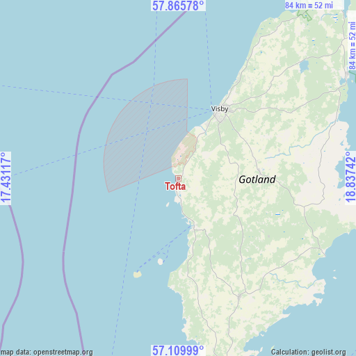
Tofta GPS coordinates[2]
57° 29' 23.424" North, 18° 8' 3.444" East
| Map corner | latitude | longitude |
|---|---|---|
| Upper-left | 57.86578°, | 17.43117° |
| Center: | 57.48984°, | 18.13429° |
| Lower-right: | 57.10999°, | 18.83742° |
| Map W x H: | 84×84 km | = 52.2×52.2mi |
| max Lat: | 67.85572° ⇑71.8% North |
| Tofta: | 57.48984° |
| min Lat: | ⇓28.2% South 55.34337° |
| min Long | Tofta | max Long |
| 11.1712° | 18.13429° | 24.13676° |
| W 87.5%⇐ | ⇒12.5% E |
Elevation
Elevation of Tofta is 13 m = 43 ft, and this is 69.6 m = 228 ft below average elevation for this country.
| Max E: |
663 m = 2175 ft | 84.8% |
| Avg. | 82.6 m = 271 ft | |
| Tofta | 13 m = 43 ft | |
Min E: |
-1 m = -3 ft | 15.2% |
See also: Sweden elevation on elevation.city.
Geographical zone
Tofta is located in North temperate zone (between Tropic of Cancer and the Arctic Circle). Distance of this North polar circle is 1008.9 km =626.9 mi to North.| Distance of | km | miles | from Tofta |
|---|---|---|---|
| North Pole | 3614.8 | 2246.1 | to North |
| Arctic Circle | 1008.9 | 626.9 | to North |
| Tropic Cancer | 3786.4 | 2352.8 | to South |
| Equator | 6392.3 | 3972 | to South |


Nearby cities:
15 places around Tofta: (largest is in red/bold)
• Figeholm
95.8 km =59.5 mi,  261°
261°
• Fårösund
68.7 km =42.7 mi,  53°
53°
• Gunnebo
98.6 km =61.3 mi,  284°
284°
• Hemse
31.5 km =19.6 mi,  152°
152°
• Klintehamn
12.2 km =7.6 mi,  160°
160°
• Löttorp
77.9 km =48.4 mi,  242°
242°
• Oskarshamn
104.1 km =64.7 mi, 256°
• Piperskärr
95.1 km =59.1 mi,  290°
290°
• Påskallavik
107.3 km =66.7 mi,  250°
250°
• Roma
19.5 km =12.1 mi,  85°
85°
• Slite
46.5 km =28.9 mi,  59°
59°
• Vibble
14.7 km =9.1 mi,  29°
29°
• Visby
19.4 km =12.1 mi, 29°
• Västervik
94 km =58.4 mi, 288°
• Österby
47.1 km =29.3 mi, 57°
Sources, notices
• [Note1] Compared only with cities in Sweden existing in our database
• [Src1] Map data: © OpenStreetMap contributors (CC-BY-SA)
• [Src2] Other city data from geonames.org with taken over terms of usage.
• [Src3] Geographical zone / Annual Mean Temperature by Robert A. Rohde @ Wikipedia
