Piperskärr geodata
Piperskärr (Kalmar) is a populated place; located in Sweden in Europe/Stockholm (GMT+2) time zone. With population of 579 people, there are 1197 cities with bigger population in this country. Compared to other cities in Sweden, 64.8% of cities are located further ↑North; 70.6% of cities are located further ←West and 71.8% of cities have higher elevation than Piperskärr. Note1


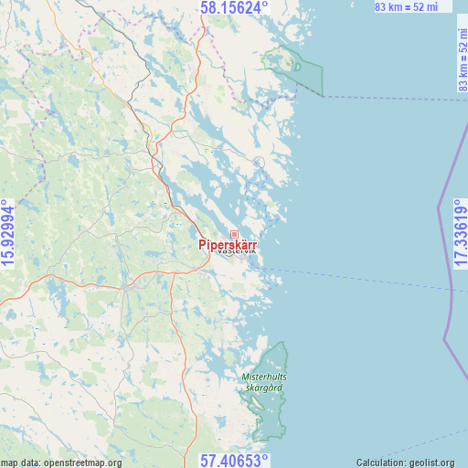
Piperskärr GPS coordinates[2]
57° 46' 59.988" North, 16° 37' 59.016" East
| Map corner | latitude | longitude |
|---|---|---|
| Upper-left | 58.15624°, | 15.92994° |
| Center: | 57.78333°, | 16.63306° |
| Lower-right: | 57.40653°, | 17.33619° |
| Map W x H: | 83.4×83.4 km | = 51.8×51.8mi |
| max Lat: | 67.85572° ⇑64.8% North |
| Piperskärr: | 57.78333° |
| min Lat: | ⇓35.2% South 55.34337° |
| min Long | Piperskärr | max Long |
| 11.1712° | 16.63306° | 24.13676° |
| W 70.6%⇐ | ⇒29.4% E |
Elevation
Elevation of Piperskärr is 23 m = 75 ft, and this is 59.6 m = 196 ft below average elevation for this country.
| Max E: |
663 m = 2175 ft | 71.8% |
| Avg. | 82.6 m = 271 ft | |
| Piperskärr | 23 m = 75 ft | |
Min E: |
-1 m = -3 ft | 28.2% |
See also: Sweden elevation on elevation.city.
Geographical zone
Piperskärr is located in North temperate zone (between Tropic of Cancer and the Arctic Circle). Distance of this North polar circle is 976.3 km =606.6 mi to North.| Distance of | km | miles | from Piperskärr |
|---|---|---|---|
| North Pole | 3582.2 | 2225.9 | to North |
| Arctic Circle | 976.3 | 606.6 | to North |
| Tropic Cancer | 3819 | 2373 | to South |
| Equator | 6424.9 | 3992.2 | to South |


Nearby cities:
15 places around Piperskärr: (largest is in red/bold)
• Ankarsrum
20.1 km =12.5 mi,  242°
242°
• Figeholm
46.6 km =29 mi,  186°
186°
• Gamleby
18.3 km =11.4 mi,  312°
312°
• Gullringen
55.3 km =34.4 mi,  271°
271°
• Gunnebo
9.5 km =5.9 mi,  218°
218°
• Gusum
54.6 km =33.9 mi,  351°
351°
• Horn
49.1 km =30.5 mi,  285°
285°
• Hultsfred
57.3 km =35.6 mi, 235°
• Kristdala
49.6 km =30.8 mi,  210°
210°
• Storebro
51.6 km =32.1 mi, 244°
• Södra Vi
50 km =31.1 mi,  264°
264°
• Valdemarsvik
46.7 km =29 mi,  357°
357°
• Vimmerby
48 km =29.8 mi,  254°
254°
• Västervik
2.8 km =1.7 mi,  174°
174°
• Överum
29.6 km =18.4 mi,  320°
320°
Sources, notices
• [Note1] Compared only with cities in Sweden existing in our database
• [Src1] Map data: © OpenStreetMap contributors (CC-BY-SA)
• [Src2] Other city data from geonames.org with taken over terms of usage.
• [Src3] Geographical zone / Annual Mean Temperature by Robert A. Rohde @ Wikipedia
