Risögrund geodata
Risögrund (Norrbotten) is a populated place; located in Sweden in Europe/Stockholm (GMT+2) time zone. With population of 594 people, there are 1181 cities with bigger population in this country. Compared to other cities in Sweden, 98.1% of cities are located further ↓South; 99.6% of cities are located further ←West and 95.4% of cities have higher elevation than Risögrund. Note1


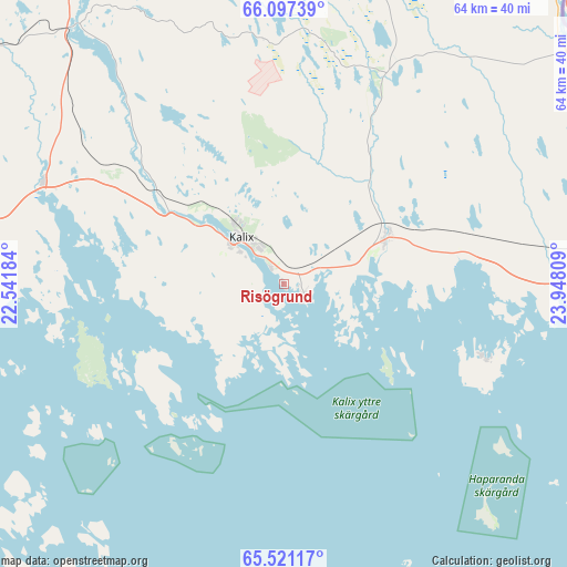
Risögrund GPS coordinates[2]
65° 48' 39.204" North, 23° 14' 41.856" East
| Map corner | latitude | longitude |
|---|---|---|
| Upper-left | 66.09739°, | 22.54184° |
| Center: | 65.81089°, | 23.24496° |
| Lower-right: | 65.52117°, | 23.94809° |
| Map W x H: | 64.1×64.1 km | = 39.8×39.8mi |
| max Lat: | 67.85572° ⇑1.9% North |
| Risögrund: | 65.81089° |
| min Lat: | ⇓98.1% South 55.34337° |
| min Long | Risögrund | max Long |
| 11.1712° | 23.24496° | 24.13676° |
| W 99.6%⇐ | ⇒0.40000000000001% E |
Elevation
Elevation of Risögrund is 5 m = 16 ft, and this is 77.6 m = 255 ft below average elevation for this country.
| Max E: |
663 m = 2175 ft | 95.4% |
| Avg. | 82.6 m = 271 ft | |
| Risögrund | 5 m = 16 ft | |
Min E: |
-1 m = -3 ft | 4.6% |
See also: Sweden elevation on elevation.city.
Geographical zone
Risögrund is located in North temperate zone (between Tropic of Cancer and the Arctic Circle). Distance of this North polar circle is 83.7 km =52 mi to North.| Distance of | km | miles | from Risögrund |
|---|---|---|---|
| North Pole | 2689.6 | 1671.2 | to North |
| Arctic Circle | 83.7 | 52 | to North |
| Tropic Cancer | 4711.6 | 2927.7 | to South |
| Equator | 7317.5 | 4546.9 | to South |


Nearby cities:
15 places around Risögrund: (largest is in red/bold)
• Bensbyn
49.5 km =30.8 mi,  247°
247°
• Bergnäset
58.1 km =36.1 mi,  243°
243°
• Björkskatan
53.5 km =33.2 mi, 245°
• Gammelstad
59.5 km =37 mi, 251°
• Haparanda
40.7 km =25.3 mi,  86°
86°
• Kalix
6.2 km =3.9 mi,  319°
319°
• Luleå
55.9 km =34.7 mi, 243°
• Långvik
57.1 km =35.5 mi,  306°
306°
• Marielund
39.4 km =24.5 mi,  83°
83°
• Nyborg
3.7 km =2.3 mi,  213°
213°
• Rolfs
7.3 km =4.5 mi, 306°
• Rutvik
55 km =34.2 mi, 253°
• Råneå
43.7 km =27.2 mi,  276°
276°
• Sangis
12.5 km =7.8 mi,  66°
66°
• Töre
29.3 km =18.2 mi,  292°
292°
Sources, notices
• [Note1] Compared only with cities in Sweden existing in our database
• [Src1] Map data: © OpenStreetMap contributors (CC-BY-SA)
• [Src2] Other city data from geonames.org with taken over terms of usage.
• [Src3] Geographical zone / Annual Mean Temperature by Robert A. Rohde @ Wikipedia
