Haparanda geodata
Haparanda (Norrbotten) is a seat of a second-order administrative division; located in Sweden in Europe/Stockholm (GMT+2) time zone. With population of 6,679 people, there are 214 cities with bigger population in this country. Compared to other cities in Sweden, 98.3% of cities are located further ↓South; 100% of cities are located further ←West and 95.4% of cities have higher elevation than Haparanda. Note1


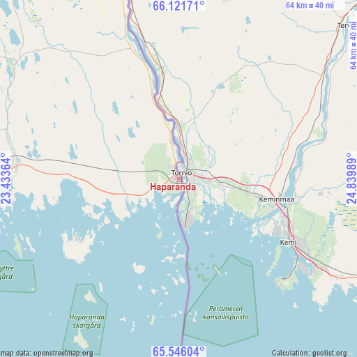
Haparanda GPS coordinates[2]
65° 50' 7.764" North, 24° 8' 12.336" East
| Map corner | latitude | longitude |
|---|---|---|
| Upper-left | 66.12171°, | 23.43364° |
| Center: | 65.83549°, | 24.13676° |
| Lower-right: | 65.54604°, | 24.83989° |
| Map W x H: | 64×64 km | = 39.8×39.8mi |
| max Lat: | 67.85572° ⇑1.7% North |
| Haparanda: | 65.83549° |
| min Lat: | ⇓98.3% South 55.34337° |
| min Long | Haparanda | max Long |
| 11.1712° | 24.13676° | 24.13676° |
| W 100%⇐ | ⇒0% E |
Elevation
Elevation of Haparanda is 5 m = 16 ft, and this is 77.6 m = 255 ft below average elevation for this country.
| Max E: |
663 m = 2175 ft | 95.4% |
| Avg. | 82.6 m = 271 ft | |
| Haparanda | 5 m = 16 ft | |
Min E: |
-1 m = -3 ft | 4.6% |
See also: Sweden elevation on elevation.city.
Geographical zone
Haparanda is located in North temperate zone (between Tropic of Cancer and the Arctic Circle). Distance of this North polar circle is 81 km =50.3 mi to North.| Distance of | km | miles | from Haparanda |
|---|---|---|---|
| North Pole | 2686.8 | 1669.5 | to North |
| Arctic Circle | 81 | 50.3 | to North |
| Tropic Cancer | 4714.3 | 2929.3 | to South |
| Equator | 7320.2 | 4548.6 | to South |


Nearby cities:
15 places around Haparanda: (largest is in red/bold)
• Bensbyn
89.2 km =55.4 mi,  256°
256°
• Björkskatan
92.9 km =57.7 mi,  254°
254°
• Kalix
44.6 km =27.7 mi,  272°
272°
• Luleå
94.9 km =59 mi, 252°
• Långvik
91.7 km =57 mi,  289°
289°
• Marielund
2.4 km =1.5 mi,  323°
323°
• Nyborg
43.1 km =26.8 mi, 262°
• Risögrund
40.7 km =25.3 mi, 266°
• Rolfs
46.4 km =28.8 mi, 271°
• Rutvik
95.2 km =59.2 mi, 258°
• Råneå
84 km =52.2 mi, 271°
• Sangis
29.2 km =18.1 mi, 274°
• Töre
68.1 km =42.3 mi,  277°
277°
• Överkalix
79.9 km =49.6 mi,  313°
313°
• Övertorneå
65.1 km =40.5 mi,  340°
340°
Sources, notices
• [Note1] Compared only with cities in Sweden existing in our database
• [Src1] Map data: © OpenStreetMap contributors (CC-BY-SA)
• [Src2] Other city data from geonames.org with taken over terms of usage.
• [Src3] Geographical zone / Annual Mean Temperature by Robert A. Rohde @ Wikipedia
