Logatec geodata
Logatec is a seat of a first-order administrative division; located in Slovenia in Europe/Ljubljana (GMT+2) time zone. With population of 8,942 people, there are 17 cities with bigger population in this country. Compared to other cities in Slovenia, 81.8% of cities are located further ↑North; 80.3% of cities are located further →East and 85.3% of cities have lower elevation than Logatec. Note1


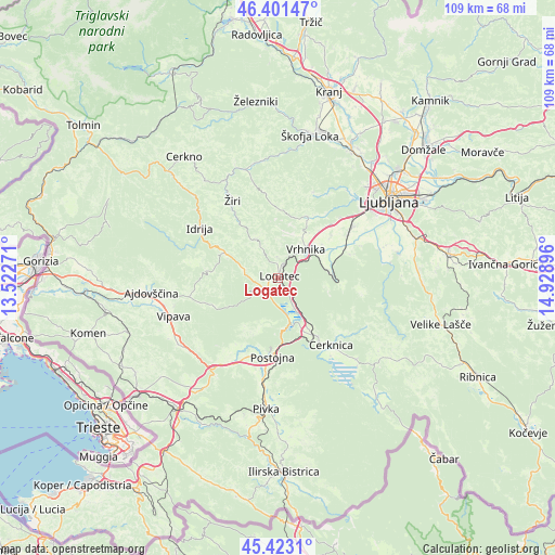
Logatec GPS coordinates[2]
45° 54' 51.984" North, 14° 13' 32.988" East
| Map corner | latitude | longitude |
|---|---|---|
| Upper-left | 46.40147°, | 13.52271° |
| Center: | 45.91444°, | 14.22583° |
| Lower-right: | 45.4231°, | 14.92896° |
| Map W x H: | 108.8×108.8 km | = 67.6×67.6mi |
| max Lat: | 46.83694° ⇑81.8% North |
| Logatec: | 45.91444° |
| min Lat: | ⇓18.2% South 45.47667° |
| min Long | Logatec | max Long |
| 13.52639° | 14.22583° | 16.4975° |
| W 19.7%⇐ | ⇒80.3% E |
Elevation
Elevation of Logatec is 473 m = 1552 ft, and this is 147.4 m = 484 ft above average elevation for this country.
| Max E: |
1551 m = 5089 ft | 14.7% |
| Logatec | 473 m 1552 ft | |
| Avg. | 325.6 m = 1068 ft | |
Min E: |
2 m = 7 ft | 85.3% |
See also: Slovenia elevation on elevation.city.
Geographical zone
Logatec is located in North temperate zone (between Tropic of Cancer and the Arctic Circle). Distance of this North polar circle is 2296 km =1426.7 mi to North.| Distance of | km | miles | from Logatec |
|---|---|---|---|
| North Pole | 4901.9 | 3045.9 | to North |
| Arctic Circle | 2296 | 1426.7 | to North |
| Tropic Cancer | 2499.3 | 1553 | to South |
| Equator | 5105.2 | 3172.2 | to South |


Nearby cities:
15 places around Logatec: (largest is in red/bold)
• Bevke
12.7 km =7.9 mi,  52°
52°
• Borovnica
10.6 km =6.6 mi,  89°
89°
• Drenov Grič
12.4 km =7.7 mi,  41°
41°
• Godovič
11.3 km =7 mi,  295°
295°
• Hotedršica
6.7 km =4.2 mi,  285°
285°
• Kalce
3.3 km =2.1 mi,  229°
229°
• Planina
9.7 km =6 mi,  168°
168°
• Rakek
13 km =8.1 mi,  149°
149°
• Rovte
8.7 km =5.4 mi,  334°
334°
• Sinja Gorica
9.9 km =6.2 mi, 46°
• Stara Vrhnika
7.9 km =4.9 mi,  32°
32°
• Unec
12.2 km =7.6 mi, 154°
• Verd
7.8 km =4.8 mi, 52°
• Vrhnika
7.6 km =4.7 mi, 44°
• Vrzdenec
12.3 km =7.6 mi,  16°
16°
Sources, notices
• [Note1] Compared only with cities in Slovenia existing in our database
• [Src1] Map data: © OpenStreetMap contributors (CC-BY-SA)
• [Src2] Other city data from geonames.org with taken over terms of usage.
• [Src3] Geographical zone / Annual Mean Temperature by Robert A. Rohde @ Wikipedia
