Šoštanj geodata
Šoštanj is a seat of a first-order administrative division; located in Slovenia in Europe/Ljubljana (GMT+2) time zone. With population of 2,880 people, there are 72 cities with bigger population in this country. Compared to other cities in Slovenia, 63.3% of cities are located further ↓South; 51.5% of cities are located further ←West and 68.3% of cities have lower elevation than Šoštanj. Note1


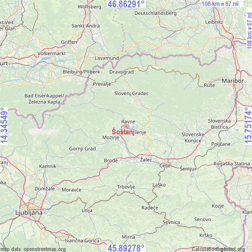
Šoštanj GPS coordinates[2]
46° 22' 48" North, 15° 2' 54.996" East
| Map corner | latitude | longitude |
|---|---|---|
| Upper-left | 46.86291°, | 14.34549° |
| Center: | 46.38°, | 15.04861° |
| Lower-right: | 45.89278°, | 15.75174° |
| Map W x H: | 107.9×107.9 km | = 67×67mi |
| max Lat: | 46.83694° ⇑36.7% North |
| Šoštanj: | 46.38° |
| min Lat: | ⇓63.3% South 45.47667° |
| min Long | Šoštanj | max Long |
| 13.52639° | 15.04861° | 16.4975° |
| W 51.5%⇐ | ⇒48.5% E |
Elevation
Elevation of Šoštanj is 361 m = 1184 ft, and this is 35.4 m = 116 ft above average elevation for this country.
| Max E: |
1551 m = 5089 ft | 31.7% |
| Šoštanj | 361 m 1184 ft | |
| Avg. | 325.6 m = 1068 ft | |
Min E: |
2 m = 7 ft | 68.3% |
See also: Slovenia elevation on elevation.city.
Geographical zone
Šoštanj is located in North temperate zone (between Tropic of Cancer and the Arctic Circle). Distance of this North polar circle is 2244.2 km =1394.5 mi to North.| Distance of | km | miles | from Šoštanj |
|---|---|---|---|
| North Pole | 4850.1 | 3013.7 | to North |
| Arctic Circle | 2244.2 | 1394.5 | to North |
| Tropic Cancer | 2551.1 | 1585.2 | to South |
| Equator | 5157 | 3204.4 | to South |


Nearby cities:
15 places around Šoštanj: (largest is in red/bold)
• Andraž nad Polzelo
7 km =4.3 mi,  151°
151°
• Braslovče
10.1 km =6.3 mi,  184°
184°
• Florjan
3.4 km =2.1 mi,  295°
295°
• Gaberke
3 km =1.9 mi,  50°
50°
• Letuš
7.4 km =4.6 mi,  194°
194°
• Lokovica
2.3 km =1.4 mi,  173°
173°
• Mozirje
7.9 km =4.9 mi,  235°
235°
• Nazarje
10.5 km =6.5 mi,  228°
228°
• Podgorje
10.6 km =6.6 mi,  14°
14°
• Podkraj pri Velenju
4.4 km =2.7 mi,  134°
134°
• Ravne
3.9 km =2.4 mi, 13°
• Topolšica
3.1 km =1.9 mi,  317°
317°
• Velenje
5.3 km =3.3 mi,  116°
116°
• Škale
4.3 km =2.7 mi,  96°
96°
• Šmartno ob Paki
5.3 km =3.3 mi, 192°
Sources, notices
• [Note1] Compared only with cities in Slovenia existing in our database
• [Src1] Map data: © OpenStreetMap contributors (CC-BY-SA)
• [Src2] Other city data from geonames.org with taken over terms of usage.
• [Src3] Geographical zone / Annual Mean Temperature by Robert A. Rohde @ Wikipedia
