Mozirje geodata
Mozirje is a seat of a first-order administrative division; located in Slovenia in Europe/Ljubljana (GMT+2) time zone. With population of 2,085 people, there are 97 cities with bigger population in this country. Compared to other cities in Slovenia, 58.8% of cities are located further ↓South; 51.2% of cities are located further →East and 62.3% of cities have lower elevation than Mozirje. Note1


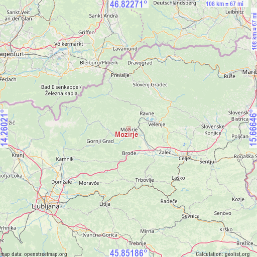
Mozirje GPS coordinates[2]
46° 20' 21.984" North, 14° 57' 47.988" East
| Map corner | latitude | longitude |
|---|---|---|
| Upper-left | 46.82271°, | 14.26021° |
| Center: | 46.33944°, | 14.96333° |
| Lower-right: | 45.85186°, | 15.66646° |
| Map W x H: | 107.9×107.9 km | = 67×67mi |
| max Lat: | 46.83694° ⇑41.2% North |
| Mozirje: | 46.33944° |
| min Lat: | ⇓58.8% South 45.47667° |
| min Long | Mozirje | max Long |
| 13.52639° | 14.96333° | 16.4975° |
| W 48.8%⇐ | ⇒51.2% E |
Elevation
Elevation of Mozirje is 337 m = 1106 ft, and this is 11.4 m = 37 ft above average elevation for this country.
| Max E: |
1551 m = 5089 ft | 37.7% |
| Mozirje | 337 m 1106 ft | |
| Avg. | 325.6 m = 1068 ft | |
Min E: |
2 m = 7 ft | 62.3% |
See also: Slovenia elevation on elevation.city.
Geographical zone
Mozirje is located in North temperate zone (between Tropic of Cancer and the Arctic Circle). Distance of this North polar circle is 2248.7 km =1397.3 mi to North.| Distance of | km | miles | from Mozirje |
|---|---|---|---|
| North Pole | 4854.6 | 3016.5 | to North |
| Arctic Circle | 2248.7 | 1397.3 | to North |
| Tropic Cancer | 2546.5 | 1582.3 | to South |
| Equator | 5152.5 | 3201.6 | to South |


Nearby cities:
15 places around Mozirje: (largest is in red/bold)
• Andraž nad Polzelo
10 km =6.2 mi,  99°
99°
• Bočna
10 km =6.2 mi,  236°
236°
• Braslovče
8 km =5 mi,  133°
133°
• Florjan
6.9 km =4.3 mi,  30°
30°
• Letuš
5.4 km =3.4 mi,  119°
119°
• Ljubno ob Savinji
10 km =6.2 mi,  272°
272°
• Lokovica
7.2 km =4.5 mi,  71°
71°
• Nazarje
2.7 km =1.7 mi,  207°
207°
• Parižlje
9.8 km =6.1 mi, 132°
• Podkraj pri Velenju
9.8 km =6.1 mi,  81°
81°
• Polzela
10.1 km =6.3 mi, 128°
• Rečica ob Savinji
4.4 km =2.7 mi,  234°
234°
• Topolšica
8.1 km =5 mi, 33°
• Šmartno ob Paki
5.4 km =3.4 mi, 97°
• Šoštanj
7.9 km =4.9 mi,  55°
55°
Sources, notices
• [Note1] Compared only with cities in Slovenia existing in our database
• [Src1] Map data: © OpenStreetMap contributors (CC-BY-SA)
• [Src2] Other city data from geonames.org with taken over terms of usage.
• [Src3] Geographical zone / Annual Mean Temperature by Robert A. Rohde @ Wikipedia
