Šentrupert geodata
Šentrupert is a seat of a first-order administrative division; located in Slovenia in Europe/Ljubljana (GMT+2) time zone. With population of 329 people, there are 577 cities with bigger population in this country. Compared to other cities in Slovenia, 75.2% of cities are located further ↑North; 55.3% of cities are located further ←West and 60.5% of cities have higher elevation than Šentrupert. Note1


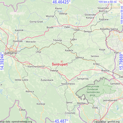
Šentrupert GPS coordinates[2]
45° 58' 40.008" North, 15° 5' 44.016" East
| Map corner | latitude | longitude |
|---|---|---|
| Upper-left | 46.46425°, | 14.39244° |
| Center: | 45.97778°, | 15.09556° |
| Lower-right: | 45.487°, | 15.79869° |
| Map W x H: | 108.7×108.7 km | = 67.5×67.5mi |
| max Lat: | 46.83694° ⇑75.2% North |
| Šentrupert: | 45.97778° |
| min Lat: | ⇓24.8% South 45.47667° |
| min Long | Šentrupert | max Long |
| 13.52639° | 15.09556° | 16.4975° |
| W 55.3%⇐ | ⇒44.7% E |
Elevation
Elevation of Šentrupert is 271 m = 889 ft, and this is 54.6 m = 179 ft below average elevation for this country.
| Max E: |
1551 m = 5089 ft | 60.5% |
| Avg. | 325.6 m = 1068 ft | |
| Šentrupert | 271 m = 889 ft | |
Min E: |
2 m = 7 ft | 39.5% |
See also: Slovenia elevation on elevation.city.
Geographical zone
Šentrupert is located in North temperate zone (between Tropic of Cancer and the Arctic Circle). Distance of this North polar circle is 2288.9 km =1422.3 mi to North.| Distance of | km | miles | from Šentrupert |
|---|---|---|---|
| North Pole | 4894.8 | 3041.5 | to North |
| Arctic Circle | 2288.9 | 1422.3 | to North |
| Tropic Cancer | 2506.3 | 1557.3 | to South |
| Equator | 5112.2 | 3176.6 | to South |


Nearby cities:
15 places around Šentrupert: (largest is in red/bold)
• Dol pri Hrastniku
18.3 km =11.4 mi,  4°
4°
• Dolenji Boštanj
15.5 km =9.6 mi,  76°
76°
• Krmelj
7.3 km =4.5 mi, 83°
• Mirna
3.6 km =2.2 mi,  226°
226°
• Mirna Peč
13.1 km =8.1 mi,  184°
184°
• Mokronog
6 km =3.7 mi,  144°
144°
• Otočec
18.3 km =11.4 mi,  146°
146°
• Radeče
12.1 km =7.5 mi,  34°
34°
• Rimske Toplice
17.7 km =11 mi,  24°
24°
• Sevnica
17.3 km =10.7 mi, 78°
• Slovenska Vas
2.5 km =1.6 mi,  186°
186°
• Trebnje
10 km =6.2 mi,  214°
214°
• Škocjan
17.1 km =10.6 mi,  117°
117°
• Šmarjeta
15.9 km =9.9 mi,  131°
131°
• Šmarješke Toplice
16.1 km =10 mi, 142°
Sources, notices
• [Note1] Compared only with cities in Slovenia existing in our database
• [Src1] Map data: © OpenStreetMap contributors (CC-BY-SA)
• [Src2] Other city data from geonames.org with taken over terms of usage.
• [Src3] Geographical zone / Annual Mean Temperature by Robert A. Rohde @ Wikipedia
