Otočec geodata
Otočec (Šmarješke Toplice) is a populated place; located in Slovenia in Europe/Ljubljana (GMT+2) time zone. With population of 776 people, there are 315 cities with bigger population in this country. Compared to other cities in Slovenia, 86.8% of cities are located further ↑North; 62% of cities are located further ←West and 78% of cities have higher elevation than Otočec. Note1


Otočec GPS coordinates[2]
45° 50' 22.812" North, 15° 13' 31.008" East
| Map corner | latitude | longitude |
|---|---|---|
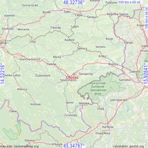
| Upper-left | 46.32736°, | 14.52216° |
| Center: | 45.83967°, | 15.22528° |
| Lower-right: | 45.34767°, | 15.92841° |
| Map W x H: | 108.9×108.9 km | = 67.7×67.7mi |
| max Lat: | 46.83694° ⇑86.8% North |
| Otočec: | 45.83967° |
| min Lat: | ⇓13.2% South 45.47667° |
| min Long | Otočec | max Long |
| 13.52639° | 15.22528° | 16.4975° |
| W 62%⇐ | ⇒38% E |
Elevation
Elevation of Otočec is 213 m = 699 ft, and this is 112.6 m = 369 ft below average elevation for this country.
| Max E: |
1551 m = 5089 ft | 78% |
| Avg. | 325.6 m = 1068 ft | |
| Otočec | 213 m = 699 ft | |
Min E: |
2 m = 7 ft | 22% |
See also: Slovenia elevation on elevation.city.
Geographical zone
Otočec is located in North temperate zone (between Tropic of Cancer and the Arctic Circle). Distance of this North polar circle is 2304.3 km =1431.8 mi to North.| Distance of | km | miles | from Otočec |
|---|---|---|---|
| North Pole | 4910.2 | 3051.1 | to North |
| Arctic Circle | 2304.3 | 1431.8 | to North |
| Tropic Cancer | 2491 | 1547.8 | to South |
| Equator | 5096.9 | 3167.1 | to South |


Nearby cities:
15 places around Otočec: (largest is in red/bold)
• Dolenjske Toplice
15.8 km =9.8 mi,  234°
234°
• Gabrje
7.5 km =4.7 mi,  148°
148°
• Kostanjevica na Krki
15.3 km =9.5 mi,  87°
87°
• Krmelj
16.4 km =10.2 mi,  350°
350°
• Mirna Peč
11.2 km =7 mi,  281°
281°
• Mokronog
12.4 km =7.7 mi,  328°
328°
• Novo Mesto
5.9 km =3.7 mi, 227°
• Slovenska Vas
16.5 km =10.3 mi,  321°
321°
• Straža
13.6 km =8.5 mi,  240°
240°
• Uršna Sela
15.5 km =9.6 mi,  209°
209°
• Velike Brusnice
4.7 km =2.9 mi, 147°
• Šentjernej
8.6 km =5.3 mi, 89°
• Škocjan
9 km =5.6 mi,  34°
34°
• Šmarjeta
5.2 km =3.2 mi,  21°
21°
• Šmarješke Toplice
2.5 km =1.6 mi, 354°
Sources, notices
• [Note1] Compared only with cities in Slovenia existing in our database
• [Src1] Map data: © OpenStreetMap contributors (CC-BY-SA)
• [Src2] Other city data from geonames.org with taken over terms of usage.
• [Src3] Geographical zone / Annual Mean Temperature by Robert A. Rohde @ Wikipedia
