Podlehnik geodata
Podlehnik is a seat of a first-order administrative division; located in Slovenia in Europe/Ljubljana (GMT+2) time zone. With population of 388 people, there are 569 cities with bigger population in this country. Compared to other cities in Slovenia, 58.2% of cities are located further ↓South; 86% of cities are located further ←West and 74.2% of cities have higher elevation than Podlehnik. Note1


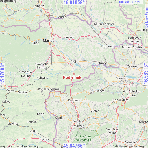
Podlehnik GPS coordinates[2]
46° 20' 7.008" North, 15° 52' 48" East
| Map corner | latitude | longitude |
|---|---|---|
| Upper-left | 46.81859°, | 15.17688° |
| Center: | 46.33528°, | 15.88° |
| Lower-right: | 45.84766°, | 16.58313° |
| Map W x H: | 108×108 km | = 67.1×67.1mi |
| max Lat: | 46.83694° ⇑41.8% North |
| Podlehnik: | 46.33528° |
| min Lat: | ⇓58.2% South 45.47667° |
| min Long | Podlehnik | max Long |
| 13.52639° | 15.88° | 16.4975° |
| W 86%⇐ | ⇒14% E |
Elevation
Elevation of Podlehnik is 231 m = 758 ft, and this is 94.6 m = 310 ft below average elevation for this country.
| Max E: |
1551 m = 5089 ft | 74.2% |
| Avg. | 325.6 m = 1068 ft | |
| Podlehnik | 231 m = 758 ft | |
Min E: |
2 m = 7 ft | 25.8% |
See also: Slovenia elevation on elevation.city.
Geographical zone
Podlehnik is located in North temperate zone (between Tropic of Cancer and the Arctic Circle). Distance of this North polar circle is 2249.2 km =1397.6 mi to North.| Distance of | km | miles | from Podlehnik |
|---|---|---|---|
| North Pole | 4855.1 | 3016.8 | to North |
| Arctic Circle | 2249.2 | 1397.6 | to North |
| Tropic Cancer | 2546.1 | 1582.1 | to South |
| Equator | 5152 | 3201.3 | to South |


Nearby cities:
15 places around Podlehnik: (largest is in red/bold)
• Apače
7.5 km =4.7 mi,  307°
307°
• Bukovci
8.7 km =5.4 mi,  48°
48°
• Cirkulane
8.9 km =5.5 mi,  83°
83°
• Draženci
5.8 km =3.6 mi,  336°
336°
• Lancova Vas
4.4 km =2.7 mi, 335°
• Lovrenc na Dravskem Polju
8.8 km =5.5 mi,  298°
298°
• Markovci
7.7 km =4.8 mi,  28°
28°
• Njiverce
9.5 km =5.9 mi,  323°
323°
• Pobrežje
5.5 km =3.4 mi,  358°
358°
• Spodnja Hajdina
8.6 km =5.3 mi, 342°
• Spuhlja
9 km =5.6 mi,  17°
17°
• Stojnci
9.4 km =5.8 mi,  57°
57°
• Videm pri Ptuju
4.2 km =2.6 mi, 28°
• Zgornja Hajdina
8.5 km =5.3 mi, 338°
• Žetale
8 km =5 mi,  210°
210°
Sources, notices
• [Note1] Compared only with cities in Slovenia existing in our database
• [Src1] Map data: © OpenStreetMap contributors (CC-BY-SA)
• [Src2] Other city data from geonames.org with taken over terms of usage.
• [Src3] Geographical zone / Annual Mean Temperature by Robert A. Rohde @ Wikipedia
