Dornava geodata
Dornava is a seat of a first-order administrative division; located in Slovenia in Europe/Ljubljana (GMT+2) time zone. With population of 1,267 people, there are 171 cities with bigger population in this country. Compared to other cities in Slovenia, 72.8% of cities are located further ↓South; 87.8% of cities are located further ←West and 77% of cities have higher elevation than Dornava. Note1


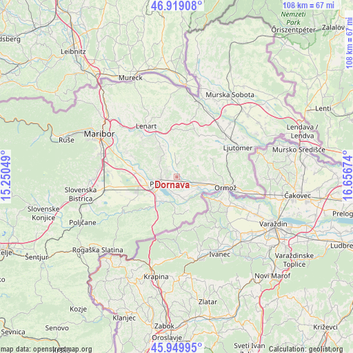
Dornava GPS coordinates[2]
46° 26' 12.012" North, 15° 57' 12.996" East
| Map corner | latitude | longitude |
|---|---|---|
| Upper-left | 46.91908°, | 15.25049° |
| Center: | 46.43667°, | 15.95361° |
| Lower-right: | 45.94995°, | 16.65674° |
| Map W x H: | 107.8×107.8 km | = 67×67mi |
| max Lat: | 46.83694° ⇑27.2% North |
| Dornava: | 46.43667° |
| min Lat: | ⇓72.8% South 45.47667° |
| min Long | Dornava | max Long |
| 13.52639° | 15.95361° | 16.4975° |
| W 87.8%⇐ | ⇒12.2% E |
Elevation
Elevation of Dornava is 217 m = 712 ft, and this is 108.6 m = 356 ft below average elevation for this country.
| Max E: |
1551 m = 5089 ft | 77% |
| Avg. | 325.6 m = 1068 ft | |
| Dornava | 217 m = 712 ft | |
Min E: |
2 m = 7 ft | 23% |
See also: Slovenia elevation on elevation.city.
Geographical zone
Dornava is located in North temperate zone (between Tropic of Cancer and the Arctic Circle). Distance of this North polar circle is 2237.9 km =1390.6 mi to North.| Distance of | km | miles | from Dornava |
|---|---|---|---|
| North Pole | 4843.8 | 3009.8 | to North |
| Arctic Circle | 2237.9 | 1390.6 | to North |
| Tropic Cancer | 2557.4 | 1589.1 | to South |
| Equator | 5163.3 | 3208.3 | to South |


Nearby cities:
15 places around Dornava: (largest is in red/bold)
• Bukovci
5.6 km =3.5 mi,  170°
170°
• Destrnik
8.4 km =5.2 mi,  317°
317°
• Gorišnica
5.2 km =3.2 mi,  117°
117°
• Juršinci
5.5 km =3.4 mi,  14°
14°
• Kicar
3.6 km =2.2 mi,  298°
298°
• Markovci
5 km =3.1 mi,  202°
202°
• Mestni Vrh
6.8 km =4.2 mi,  276°
276°
• Moškanjci
3.5 km =2.2 mi, 120°
• Pobrežje
8.2 km =5.1 mi,  224°
224°
• Podvinci
2.9 km =1.8 mi,  260°
260°
• Ptuj
6.7 km =4.2 mi,  253°
253°
• Spuhlja
4 km =2.5 mi,  227°
227°
• Stojnci
6.6 km =4.1 mi,  160°
160°
• Videm pri Ptuju
8.4 km =5.2 mi,  205°
205°
• Zamušani
6 km =3.7 mi,  105°
105°
Sources, notices
• [Note1] Compared only with cities in Slovenia existing in our database
• [Src1] Map data: © OpenStreetMap contributors (CC-BY-SA)
• [Src2] Other city data from geonames.org with taken over terms of usage.
• [Src3] Geographical zone / Annual Mean Temperature by Robert A. Rohde @ Wikipedia
