Ročevnica geodata
Ročevnica (Tržič) is a populated place; located in Slovenia in Europe/Ljubljana (GMT+2) time zone. With population of 529 people, there are 511 cities with bigger population in this country. Compared to other cities in Slovenia, 60.7% of cities are located further ↓South; 78.5% of cities are located further →East and 94.7% of cities have lower elevation than Ročevnica. Note1


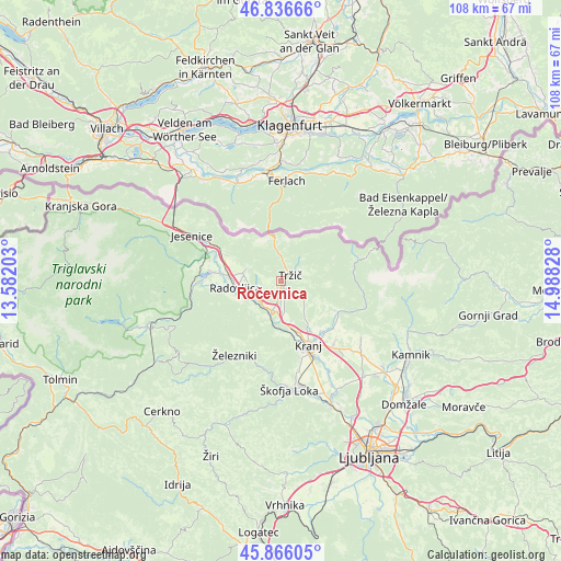
Ročevnica GPS coordinates[2]
46° 21' 12.636" North, 14° 17' 6.54" East
| Map corner | latitude | longitude |
|---|---|---|
| Upper-left | 46.83666°, | 13.58203° |
| Center: | 46.35351°, | 14.28515° |
| Lower-right: | 45.86605°, | 14.98828° |
| Map W x H: | 107.9×107.9 km | = 67×67mi |
| max Lat: | 46.83694° ⇑39.3% North |
| Ročevnica: | 46.35351° |
| min Lat: | ⇓60.7% South 45.47667° |
| min Long | Ročevnica | max Long |
| 13.52639° | 14.28515° | 16.4975° |
| W 21.5%⇐ | ⇒78.5% E |
Elevation
Elevation of Ročevnica is 597 m = 1959 ft, and this is 271.4 m = 890 ft above average elevation for this country.
| Max E: |
1551 m = 5089 ft | 5.3% |
| Ročevnica | 597 m 1959 ft | |
| Avg. | 325.6 m = 1068 ft | |
Min E: |
2 m = 7 ft | 94.7% |
See also: Slovenia elevation on elevation.city.
Geographical zone
Ročevnica is located in North temperate zone (between Tropic of Cancer and the Arctic Circle). Distance of this North polar circle is 2247.1 km =1396.3 mi to North.| Distance of | km | miles | from Ročevnica |
|---|---|---|---|
| North Pole | 4853 | 3015.5 | to North |
| Arctic Circle | 2247.1 | 1396.3 | to North |
| Tropic Cancer | 2548.1 | 1583.3 | to South |
| Equator | 5154 | 3202.5 | to South |


Nearby cities:
15 places around Ročevnica: (largest is in red/bold)
• Begunje na Gorenjskem
6.2 km =3.9 mi,  302°
302°
• Bistrica pri Tržiču
0.5 km =0.3 mi,  74°
74°
• Brezje
4.9 km =3 mi,  236°
236°
• Golnik
4.3 km =2.7 mi,  121°
121°
• Kamna Gorica
7.7 km =4.8 mi, 237°
• Kovor
0.4 km =0.2 mi,  199°
199°
• Križe
1.7 km =1.1 mi,  133°
133°
• Podbrezje
6 km =3.7 mi,  181°
181°
• Podljubelj
6.5 km =4 mi,  353°
353°
• Pristava
1.3 km =0.8 mi,  113°
113°
• Radovljica
8.6 km =5.3 mi,  263°
263°
• Spodnje Duplje
6.1 km =3.8 mi,  169°
169°
• Strahinj
8.2 km =5.1 mi,  162°
162°
• Tržič
2.2 km =1.4 mi,  60°
60°
• Zgornje Duplje
5.2 km =3.2 mi, 174°
Sources, notices
• [Note1] Compared only with cities in Slovenia existing in our database
• [Src1] Map data: © OpenStreetMap contributors (CC-BY-SA)
• [Src2] Other city data from geonames.org with taken over terms of usage.
• [Src3] Geographical zone / Annual Mean Temperature by Robert A. Rohde @ Wikipedia
