Svätý Kríž geodata
Svätý Kríž (Žilinský kraj) is a populated place; located in Slovakia in Europe/Bratislava (GMT+2) time zone. With population of 811 people, there are 157 cities with bigger population in this country. Compared to other cities in Slovakia, 70% of cities are located further ↓South; 62.4% of cities are located further ←West and 90.6% of cities have lower elevation than Svätý Kríž. Note1
Administrative division(s):
- Level 1: Žilinský kraj
- Level 2: Okres Liptovský Mikuláš
- Level 3: Svätý Kríž


Svätý Kríž GPS coordinates[2]
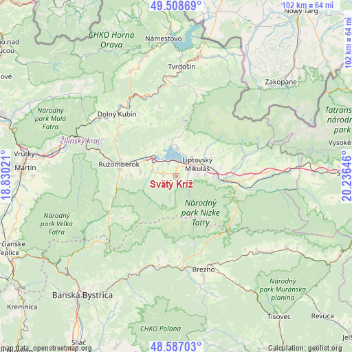
49° 3' 0" North, 19° 31' 59.988" East
| Map corner | latitude | longitude |
|---|---|---|
| Upper-left | 49.50869°, | 18.83021° |
| Center: | 49.05°, | 19.53333° |
| Lower-right: | 48.58703°, | 20.23646° |
| Map W x H: | 102.5×102.5 km | = 63.7×63.7mi |
| max Lat: | 49.43503° ⇑30% North |
| Svätý Kríž: | 49.05° |
| min Lat: | ⇓70% South 47.76356° |
| min Long | Svätý Kríž | max Long |
| 16.9786° | 19.53333° | 22.18136° |
| W 62.4%⇐ | ⇒37.6% E |
Elevation
Elevation of Svätý Kríž is 626 m = 2054 ft, and this is 289.9 m = 951 ft above average elevation for this country.
| Max E: |
1006 m = 3301 ft | 9.4% |
| Svätý Kríž | 626 m 2054 ft | |
| Avg. | 336.1 m = 1103 ft | |
Min E: |
102 m = 335 ft | 90.6% |
See also: Slovakia elevation on elevation.city.
Geographical zone
Svätý Kríž is located in North temperate zone (between Tropic of Cancer and the Arctic Circle). Distance of this North polar circle is 1947.3 km =1210 mi to North.| Distance of | km | miles | from Svätý Kríž |
|---|---|---|---|
| North Pole | 4553.2 | 2829.2 | to North |
| Arctic Circle | 1947.3 | 1210 | to North |
| Tropic Cancer | 2847.9 | 1769.6 | to South |
| Equator | 5453.8 | 3388.8 | to South |


Nearby cities:
15 places around Svätý Kríž: (largest is in red/bold)
• Bešeňová
9.1 km =5.7 mi,  307°
307°
• Brezno
28.3 km =17.6 mi,  164°
164°
• Dolný Kubín
24.4 km =15.2 mi,  316°
316°
• Hybe
21.6 km =13.4 mi,  91°
91°
• Liptovská Sielnica
10.4 km =6.5 mi,  352°
352°
• Liptovský Hrádok
13.9 km =8.6 mi, 94°
• Liptovský Mikuláš
7.3 km =4.5 mi,  62°
62°
• Liptovský Trnovec
7.9 km =4.9 mi,  7°
7°
• Lúčky
13 km =8.1 mi, 312°
• Mýto pod Ďumbierom
23.2 km =14.4 mi, 161°
• Nižná
29 km =18 mi,  358°
358°
• Oravský Podzámok
26.6 km =16.5 mi,  331°
331°
• Pribylina
19.8 km =12.3 mi,  73°
73°
• Párnica
29.2 km =18.1 mi,  303°
303°
• Ružomberok
16.7 km =10.4 mi,  279°
279°
Sources, notices
• [Note1] Compared only with cities in Slovakia existing in our database
• [Src1] Map data: © OpenStreetMap contributors (CC-BY-SA)
• [Src2] Other city data from geonames.org with taken over terms of usage.
• [Src3] Geographical zone / Annual Mean Temperature by Robert A. Rohde @ Wikipedia
