Lúčky geodata
Lúčky (Žilinský kraj) is a populated place; located in Slovakia in Europe/Bratislava (GMT+2) time zone. With population of 1,787 people, there are 136 cities with bigger population in this country. Compared to other cities in Slovakia, 81.2% of cities are located further ↓South; 58.2% of cities are located further ←West and 86.5% of cities have lower elevation than Lúčky. Note1


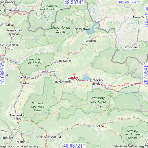
Lúčky GPS coordinates[2]
49° 7' 45.984" North, 19° 24' 8.208" East
| Map corner | latitude | longitude |
|---|---|---|
| Upper-left | 49.5874°, | 18.69916° |
| Center: | 49.12944°, | 19.40228° |
| Lower-right: | 48.66721°, | 20.10541° |
| Map W x H: | 102.3×102.3 km | = 63.6×63.6mi |
| max Lat: | 49.43503° ⇑18.8% North |
| Lúčky: | 49.12944° |
| min Lat: | ⇓81.2% South 47.76356° |
| min Long | Lúčky | max Long |
| 16.9786° | 19.40228° | 22.18136° |
| W 58.2%⇐ | ⇒41.8% E |
Elevation
Elevation of Lúčky is 591 m = 1939 ft, and this is 254.9 m = 836 ft above average elevation for this country.
| Max E: |
1006 m = 3301 ft | 13.5% |
| Lúčky | 591 m 1939 ft | |
| Avg. | 336.1 m = 1103 ft | |
Min E: |
102 m = 335 ft | 86.5% |
See also: Slovakia elevation on elevation.city.
Geographical zone
Lúčky is located in North temperate zone (between Tropic of Cancer and the Arctic Circle). Distance of this North polar circle is 1938.5 km =1204.5 mi to North.| Distance of | km | miles | from Lúčky |
|---|---|---|---|
| North Pole | 4544.4 | 2823.8 | to North |
| Arctic Circle | 1938.5 | 1204.5 | to North |
| Tropic Cancer | 2856.8 | 1775.1 | to South |
| Equator | 5462.7 | 3394.4 | to South |


Nearby cities:
15 places around Lúčky: (largest is in red/bold)
• Bešeňová
4 km =2.5 mi,  144°
144°
• Dolný Kubín
11.5 km =7.1 mi,  321°
321°
• Krušetnica
27.7 km =17.2 mi,  350°
350°
• Liptovská Sielnica
8.3 km =5.2 mi,  79°
79°
• Liptovský Hrádok
25.4 km =15.8 mi,  113°
113°
• Liptovský Mikuláš
16.9 km =10.5 mi, 108°
• Liptovský Trnovec
10.6 km =6.6 mi,  95°
95°
• Nižná
22 km =13.7 mi,  23°
23°
• Oravský Podzámok
14.8 km =9.2 mi, 347°
• Pribylina
28.7 km =17.8 mi, 96°
• Párnica
16.5 km =10.3 mi,  295°
295°
• Ružomberok
9.2 km =5.7 mi,  228°
228°
• Svätý Kríž
13 km =8.1 mi,  132°
132°
• Trstená
29.9 km =18.6 mi,  30°
30°
• Tvrdošín
25.6 km =15.9 mi, 25°
Sources, notices
• [Note1] Compared only with cities in Slovakia existing in our database
• [Src1] Map data: © OpenStreetMap contributors (CC-BY-SA)
• [Src2] Other city data from geonames.org with taken over terms of usage.
• [Src3] Geographical zone / Annual Mean Temperature by Robert A. Rohde @ Wikipedia
