Bešeňová geodata
Bešeňová (Žilinský kraj) is a populated place; located in Slovakia in Europe/Bratislava (GMT+2) time zone. With population of 667 people, there are 160 cities with bigger population in this country. Compared to other cities in Slovakia, 75.9% of cities are located further ↓South; 59.4% of cities are located further ←West and 77.1% of cities have lower elevation than Bešeňová. Note1


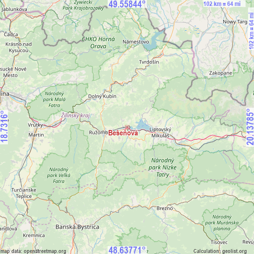
Bešeňová GPS coordinates[2]
49° 6' 0.756" North, 19° 26' 4.992" East
| Map corner | latitude | longitude |
|---|---|---|
| Upper-left | 49.55844°, | 18.7316° |
| Center: | 49.10021°, | 19.43472° |
| Lower-right: | 48.63771°, | 20.13785° |
| Map W x H: | 102.4×102.4 km | = 63.6×63.6mi |
| max Lat: | 49.43503° ⇑24.1% North |
| Bešeňová: | 49.10021° |
| min Lat: | ⇓75.9% South 47.76356° |
| min Long | Bešeňová | max Long |
| 16.9786° | 19.43472° | 22.18136° |
| W 59.4%⇐ | ⇒40.6% E |
Elevation
Elevation of Bešeňová is 510 m = 1673 ft, and this is 173.9 m = 571 ft above average elevation for this country.
| Max E: |
1006 m = 3301 ft | 22.9% |
| Bešeňová | 510 m 1673 ft | |
| Avg. | 336.1 m = 1103 ft | |
Min E: |
102 m = 335 ft | 77.1% |
See also: Slovakia elevation on elevation.city.
Geographical zone
Bešeňová is located in North temperate zone (between Tropic of Cancer and the Arctic Circle). Distance of this North polar circle is 1941.7 km =1206.5 mi to North.| Distance of | km | miles | from Bešeňová |
|---|---|---|---|
| North Pole | 4547.6 | 2825.7 | to North |
| Arctic Circle | 1941.7 | 1206.5 | to North |
| Tropic Cancer | 2853.5 | 1773.1 | to South |
| Equator | 5459.4 | 3392.3 | to South |


Nearby cities:
15 places around Bešeňová: (largest is in red/bold)
• Dolný Kubín
15.5 km =9.6 mi,  321°
321°
• Hybe
29.4 km =18.3 mi,  102°
102°
• Liptovská Sielnica
7.5 km =4.7 mi,  50°
50°
• Liptovský Hrádok
22.1 km =13.7 mi,  107°
107°
• Liptovský Mikuláš
13.8 km =8.6 mi, 99°
• Liptovský Trnovec
8.5 km =5.3 mi,  74°
74°
• Lúčky
4 km =2.5 mi, 324°
• Mýto pod Ďumbierom
31.2 km =19.4 mi,  152°
152°
• Nižná
24.3 km =15.1 mi,  15°
15°
• Oravský Podzámok
18.6 km =11.6 mi,  342°
342°
• Pribylina
26.2 km =16.3 mi,  90°
90°
• Párnica
20.2 km =12.6 mi,  301°
301°
• Ružomberok
9.7 km =6 mi,  253°
253°
• Svätý Kríž
9.1 km =5.7 mi,  127°
127°
• Tvrdošín
27.8 km =17.3 mi, 18°
Sources, notices
• [Note1] Compared only with cities in Slovakia existing in our database
• [Src1] Map data: © OpenStreetMap contributors (CC-BY-SA)
• [Src2] Other city data from geonames.org with taken over terms of usage.
• [Src3] Geographical zone / Annual Mean Temperature by Robert A. Rohde @ Wikipedia
