Bratislava geodata
Bratislava (Bratislavský kraj) is a capital of a political entity; located in Slovakia in Europe/Bratislava (GMT+2) time zone. With population of 423,737 people, there are 0 cities with bigger population in this country. Compared to other cities in Slovakia, 90.6% of cities are located further ↑North; 97.6% of cities are located further →East and 78.2% of cities have higher elevation than Bratislava. Note1


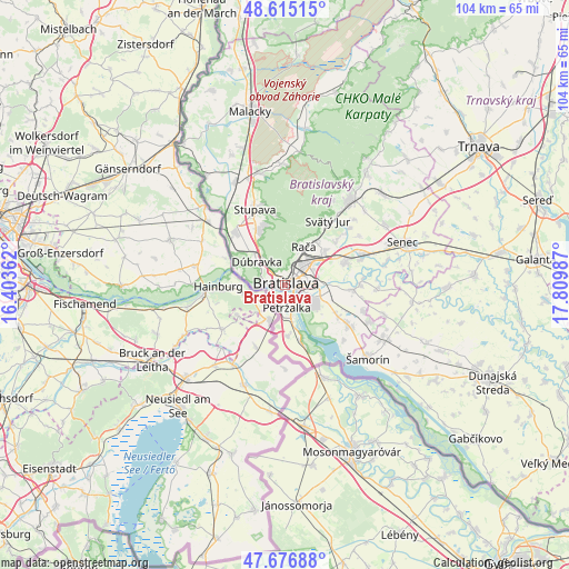
Bratislava GPS coordinates[2]
48° 8' 53.376" North, 17° 6' 24.264" East
| Map corner | latitude | longitude |
|---|---|---|
| Upper-left | 48.61515°, | 16.40362° |
| Center: | 48.14816°, | 17.10674° |
| Lower-right: | 47.67688°, | 17.80987° |
| Map W x H: | 104.3×104.3 km | = 64.8×64.8mi |
| max Lat: | 49.43503° ⇑90.6% North |
| Bratislava: | 48.14816° |
| min Lat: | ⇓9.4% South 47.76356° |
| min Long | Bratislava | max Long |
| 16.9786° | 17.10674° | 22.18136° |
| W 2.4%⇐ | ⇒97.6% E |
Elevation
Elevation of Bratislava is 157 m = 515 ft, and this is 179.1 m = 588 ft below average elevation for this country.
| Max E: |
1006 m = 3301 ft | 78.2% |
| Avg. | 336.1 m = 1103 ft | |
| Bratislava | 157 m = 515 ft | |
Min E: |
102 m = 335 ft | 21.8% |
See also: Bratislava elevation on elevation.city.
Geographical zone
Bratislava is located in North temperate zone (between Tropic of Cancer and the Arctic Circle). Distance of this North polar circle is 2047.6 km =1272.3 mi to North.| Distance of | km | miles | from Bratislava |
|---|---|---|---|
| North Pole | 4653.5 | 2891.5 | to North |
| Arctic Circle | 2047.6 | 1272.3 | to North |
| Tropic Cancer | 2747.7 | 1707.3 | to South |
| Equator | 5353.6 | 3326.6 | to South |


Nearby cities:
15 places around Bratislava: (largest is in red/bold)
• Bratislava - Vajnory
9.8 km =6.1 mi,  49°
49°
• Devínska Nová Ves
11.5 km =7.1 mi,  304°
304°
• Dunajská Lužná
13.5 km =8.4 mi,  122°
122°
• Dunajská Streda
41.3 km =25.7 mi,  114°
114°
• Ivanka pri Dunaji
11.8 km =7.3 mi,  68°
68°
• Malacky
32.6 km =20.3 mi,  348°
348°
• Marianka
11.7 km =7.3 mi,  344°
344°
• Modra
25.4 km =15.8 mi,  35°
35°
• Pezinok
19.7 km =12.2 mi, 36°
• Senec
23.2 km =14.4 mi, 69°
• Sládkovičovo
39.9 km =24.8 mi,  81°
81°
• Stupava
15.1 km =9.4 mi, 338°
• Svätý Jur
14.1 km =8.8 mi,  34°
34°
• Vinosady
22.7 km =14.1 mi, 36°
• Šamorín
20 km =12.4 mi,  131°
131°
Sources, notices
• [Note1] Compared only with cities in Slovakia existing in our database
• [Src1] Map data: © OpenStreetMap contributors (CC-BY-SA)
• [Src2] Other city data from geonames.org with taken over terms of usage.
• [Src3] Geographical zone / Annual Mean Temperature by Robert A. Rohde @ Wikipedia
