Rimavská Sobota geodata
Rimavská Sobota (Banskobystrický kraj) is a seat of a second-order administrative division; located in Slovakia in Europe/Bratislava (GMT+2) time zone. With population of 25,235 people, there are 25 cities with bigger population in this country. Compared to other cities in Slovakia, 76.5% of cities are located further ↑North; 71.2% of cities are located further ←West and 63.5% of cities have higher elevation than Rimavská Sobota. Note1
Administrative division(s):
- Level 1: Banskobystrický kraj
- Level 2: Okres Rimavská Sobota
- Level 3: Rimavská Sobota


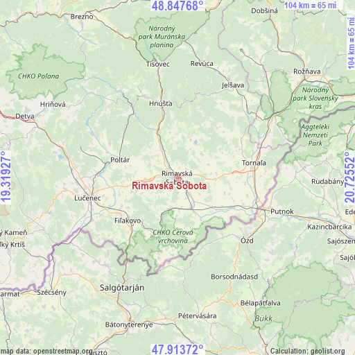
Rimavská Sobota GPS coordinates[2]
48° 22' 58.224" North, 20° 1' 20.604" East
| Map corner | latitude | longitude |
|---|---|---|
| Upper-left | 48.84768°, | 19.31927° |
| Center: | 48.38284°, | 20.02239° |
| Lower-right: | 47.91372°, | 20.72552° |
| Map W x H: | 103.8×103.8 km | = 64.5×64.5mi |
| max Lat: | 49.43503° ⇑76.5% North |
| Rimavská Sobota: | 48.38284° |
| min Lat: | ⇓23.5% South 47.76356° |
| min Long | Rimavská Sobot | max Long |
| 16.9786° | 20.02239° | 22.18136° |
| W 71.2%⇐ | ⇒28.8% E |
Elevation
Elevation of Rimavská Sobota is 208 m = 682 ft, and this is 128.1 m = 420 ft below average elevation for this country.
| Max E: |
1006 m = 3301 ft | 63.5% |
| Avg. | 336.1 m = 1103 ft | |
| Rimavská Sobota | 208 m = 682 ft | |
Min E: |
102 m = 335 ft | 36.5% |
See also: Slovakia elevation on elevation.city.
Geographical zone
Rimavská Sobota is located in North temperate zone (between Tropic of Cancer and the Arctic Circle). Distance of this North polar circle is 2021.5 km =1256.1 mi to North.| Distance of | km | miles | from Rimavská Sobota |
|---|---|---|---|
| North Pole | 4627.4 | 2875.3 | to North |
| Arctic Circle | 2021.5 | 1256.1 | to North |
| Tropic Cancer | 2773.7 | 1723.5 | to South |
| Equator | 5379.7 | 3342.8 | to South |


Nearby cities:
15 places around Rimavská Sobota: (largest is in red/bold)
• Betliar
50.4 km =31.3 mi,  45°
45°
• Brezno
54.8 km =34.1 mi,  328°
328°
• Detva
48.6 km =30.2 mi,  294°
294°
• Dobšiná
55 km =34.2 mi,  27°
27°
• Fiľakovo
19.4 km =12.1 mi,  228°
228°
• Hriňová
42.5 km =26.4 mi,  300°
300°
• Hrochoť,Slovakia
60.4 km =37.5 mi, 300°
• Lučenec
26.8 km =16.7 mi,  257°
257°
• Mýto pod Ďumbierom
59.5 km =37 mi, 331°
• Poltár
17.7 km =11 mi, 287°
• Revúca
34.1 km =21.2 mi,  11°
11°
• Rožňava
48.9 km =30.4 mi, 50°
• Tisovec
33.3 km =20.7 mi,  349°
349°
• Veľký Krtíš
53.3 km =33.1 mi,  248°
248°
• Čierny Balog
48.9 km =30.4 mi, 326°
Sources, notices
• [Note1] Compared only with cities in Slovakia existing in our database
• [Src1] Map data: © OpenStreetMap contributors (CC-BY-SA)
• [Src2] Other city data from geonames.org with taken over terms of usage.
• [Src3] Geographical zone / Annual Mean Temperature by Robert A. Rohde @ Wikipedia
