Detva geodata
Detva (Banskobystrický kraj) is a populated place; located in Slovakia in Europe/Bratislava (GMT+2) time zone. With population of 15,020 people, there are 50 cities with bigger population in this country. Compared to other cities in Slovakia, 68.8% of cities are located further ↑North; 58.8% of cities are located further ←West and 67.6% of cities have lower elevation than Detva. Note1


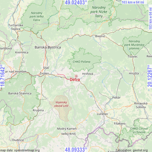
Detva GPS coordinates[2]
48° 33' 38.952" North, 19° 25' 10.344" East
| Map corner | latitude | longitude |
|---|---|---|
| Upper-left | 49.02403°, | 18.71642° |
| Center: | 48.56082°, | 19.41954° |
| Lower-right: | 48.09333°, | 20.12267° |
| Map W x H: | 103.5×103.5 km | = 64.3×64.3mi |
| max Lat: | 49.43503° ⇑68.8% North |
| Detva: | 48.56082° |
| min Lat: | ⇓31.2% South 47.76356° |
| min Long | Detva | max Long |
| 16.9786° | 19.41954° | 22.18136° |
| W 58.8%⇐ | ⇒41.2% E |
Elevation
Elevation of Detva is 414 m = 1358 ft, and this is 77.9 m = 256 ft above average elevation for this country.
| Max E: |
1006 m = 3301 ft | 32.4% |
| Detva | 414 m 1358 ft | |
| Avg. | 336.1 m = 1103 ft | |
Min E: |
102 m = 335 ft | 67.6% |
See also: Slovakia elevation on elevation.city.
Geographical zone
Detva is located in North temperate zone (between Tropic of Cancer and the Arctic Circle). Distance of this North polar circle is 2001.7 km =1243.8 mi to North.| Distance of | km | miles | from Detva |
|---|---|---|---|
| North Pole | 4607.6 | 2863 | to North |
| Arctic Circle | 2001.7 | 1243.8 | to North |
| Tropic Cancer | 2793.5 | 1735.8 | to South |
| Equator | 5399.5 | 3355.1 | to South |


Nearby cities:
15 places around Detva: (largest is in red/bold)
• Banská Bystrica
27.9 km =17.3 mi,  315°
315°
• Banská Štiavnica
39.6 km =24.6 mi,  251°
251°
• Brezno
31.4 km =19.5 mi,  30°
30°
• Hriňová
8 km =5 mi,  76°
76°
• Hrochoť,Slovakia
13.1 km =8.1 mi, 323°
• Kováčová
23.8 km =14.8 mi,  280°
280°
• Kremnica
40.2 km =25 mi,  293°
293°
• Krupina
34.7 km =21.6 mi,  228°
228°
• Lučenec
31.3 km =19.4 mi,  144°
144°
• Mýto pod Ďumbierom
35.9 km =22.3 mi, 25°
• Poltár
31.1 km =19.3 mi,  117°
117°
• Svätý Anton
38.7 km =24 mi, 245°
• Veľký Krtíš
39.3 km =24.4 mi,  187°
187°
• Zvolen
19.7 km =12.2 mi,  274°
274°
• Čierny Balog
26.8 km =16.7 mi,  39°
39°
Sources, notices
• [Note1] Compared only with cities in Slovakia existing in our database
• [Src1] Map data: © OpenStreetMap contributors (CC-BY-SA)
• [Src2] Other city data from geonames.org with taken over terms of usage.
• [Src3] Geographical zone / Annual Mean Temperature by Robert A. Rohde @ Wikipedia
