Čierny Balog geodata
Čierny Balog (Banskobystrický kraj) is a populated place; located in Slovakia in Europe/Bratislava (GMT+2) time zone. With population of 5,234 people, there are 108 cities with bigger population in this country. Compared to other cities in Slovakia, 51.2% of cities are located further ↑North; 66.5% of cities are located further ←West and 80.6% of cities have lower elevation than Čierny Balog. Note1
Administrative division(s):
- Level 1: Banskobystrický kraj
- Level 2: Okres Brezno
- Level 3: Čierny Balog


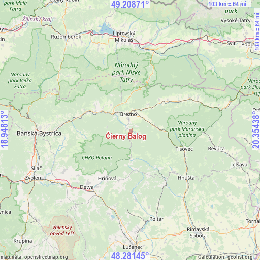
Čierny Balog GPS coordinates[2]
48° 44' 49.992" North, 19° 39' 4.5" East
| Map corner | latitude | longitude |
|---|---|---|
| Upper-left | 49.20871°, | 18.94813° |
| Center: | 48.74722°, | 19.65125° |
| Lower-right: | 48.28145°, | 20.35438° |
| Map W x H: | 103.1×103.1 km | = 64.1×64.1mi |
| max Lat: | 49.43503° ⇑51.2% North |
| Čierny Balog: | 48.74722° |
| min Lat: | ⇓48.8% South 47.76356° |
| min Long | Čierny Balog | max Long |
| 16.9786° | 19.65125° | 22.18136° |
| W 66.5%⇐ | ⇒33.5% E |
Elevation
Elevation of Čierny Balog is 530 m = 1739 ft, and this is 193.9 m = 636 ft above average elevation for this country.
| Max E: |
1006 m = 3301 ft | 19.4% |
| Čierny Balog | 530 m 1739 ft | |
| Avg. | 336.1 m = 1103 ft | |
Min E: |
102 m = 335 ft | 80.6% |
See also: Slovakia elevation on elevation.city.
Geographical zone
Čierny Balog is located in North temperate zone (between Tropic of Cancer and the Arctic Circle). Distance of this North polar circle is 1981 km =1230.9 mi to North.| Distance of | km | miles | from Čierny Balog |
|---|---|---|---|
| North Pole | 4586.9 | 2850.2 | to North |
| Arctic Circle | 1981 | 1230.9 | to North |
| Tropic Cancer | 2814.3 | 1748.7 | to South |
| Equator | 5420.2 | 3368 | to South |


Nearby cities:
15 places around Čierny Balog: (largest is in red/bold)
• Banská Bystrica
36.5 km =22.7 mi,  268°
268°
• Brezno
6.4 km =4 mi,  350°
350°
• Detva
26.8 km =16.7 mi,  219°
219°
• Hriňová
21 km =13 mi,  206°
206°
• Hrochoť,Slovakia
26.8 km =16.7 mi,  247°
247°
• Hybe
35.5 km =22.1 mi,  21°
21°
• Liptovský Hrádok
32.9 km =20.4 mi,  9°
9°
• Liptovský Mikuláš
37.1 km =23.1 mi,  356°
356°
• Mýto pod Ďumbierom
11.7 km =7.3 mi, 353°
• Poltár
36.7 km =22.8 mi,  163°
163°
• Pribylina
40.5 km =25.2 mi, 14°
• Revúca
34.9 km =21.7 mi,  101°
101°
• Svätý Kríž
34.8 km =21.6 mi, 345°
• Tisovec
22.8 km =14.2 mi,  109°
109°
• Zvolen
41.3 km =25.7 mi,  242°
242°
Sources, notices
• [Note1] Compared only with cities in Slovakia existing in our database
• [Src1] Map data: © OpenStreetMap contributors (CC-BY-SA)
• [Src2] Other city data from geonames.org with taken over terms of usage.
• [Src3] Geographical zone / Annual Mean Temperature by Robert A. Rohde @ Wikipedia
