Totness geodata
Totness (Coronie) is a seat of a first-order administrative division; located in Suriname in America/Paramaribo (GMT-3) time zone. With population of 1,685 people, there are 12 cities with bigger population in this country. Compared to other cities in Suriname, 76.9% of cities are located further ↓South; 84.6% of cities are located further →East and 76.9% of cities have lower elevation than Totness. Note1


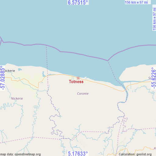
Totness GPS coordinates[2]
5° 52' 34.248" North, 56° 19' 32.592" West
| Map corner | latitude | longitude |
|---|---|---|
| Upper-left | 6.57515°, | -57.02885° |
| Center: | 5.87618°, | -56.32572° |
| Lower-right: | 5.17633°, | -55.6226° |
| Map W x H: | 155.5×155.5 km | = 96.6×96.6mi |
| max Lat: | 5.92606° ⇑23.1% North |
| Totness: | 5.87618° |
| min Lat: | ⇓76.9% South 3.67207° |
| min Long | Totness | max Long |
| -56.97297° | -56.32572° | -54.05522° |
| W 15.4%⇐ | ⇒84.6% E |
Elevation
Elevation of Totness is 16 m = 52 ft, and this is 2.9 m = 10 ft below average elevation for this country.
| Max E: |
99 m = 325 ft | 23.1% |
| Avg. | 18.9 m = 62 ft | |
| Totness | 16 m = 52 ft | |
Min E: |
1 m = 3 ft | 76.9% |
See also: Suriname elevation on elevation.city.
Geographical zone
Totness is located in North Torrid zone (between Equator and Tropic of Cancer). Distance of Equator is 653.4 km =406 mi to South.| Distance of | km | miles | from Totness |
|---|---|---|---|
| North Pole | 9353.7 | 5812.1 | to North |
| Arctic Circle | 6747.8 | 4192.9 | to North |
| Tropic Cancer | 1952.5 | 1213.2 | to North |
| Equator | 653.4 | 406 | to South |


Nearby cities:
13 places around Totness: (largest is in red/bold)
• Albina
254.7 km =158.3 mi,  99°
99°
• Benzdorp (Monte Hermon)
347.4 km =215.9 mi,  134°
134°
• Brokopondo
174.6 km =108.5 mi,  121°
121°
• Brownsweg
162 km =100.7 mi, 126°
• Groningen
95.4 km =59.3 mi, 95°
• Lelydorp
122.4 km =76.1 mi, 99°
• Mariënburg
141.9 km =88.2 mi,  89°
89°
• Moengo
214.9 km =133.5 mi, 97°
• Nieuw Amsterdam
136.8 km =85 mi, 89°
• Nieuw Nickerie
71.8 km =44.6 mi,  274°
274°
• Onverwacht
129.1 km =80.2 mi, 104°
• Paramaribo
128.2 km =79.7 mi, 90°
• Wageningen
39.7 km =24.7 mi,  251°
251°
Sources, notices
• [Note1] Compared only with cities in Suriname existing in our database
• [Src1] Map data: © OpenStreetMap contributors (CC-BY-SA)
• [Src2] Other city data from geonames.org with taken over terms of usage.
• [Src3] Geographical zone / Annual Mean Temperature by Robert A. Rohde @ Wikipedia
