Onverwacht geodata
Onverwacht (Para) is a seat of a first-order administrative division; located in Suriname in America/Paramaribo (GMT-3) time zone. With population of 2,105 people, there are 11 cities with bigger population in this country. Compared to other cities in Suriname, 69.2% of cities are located further ↑North; 61.5% of cities are located further →East and 61.5% of cities have higher elevation than Onverwacht. Note1


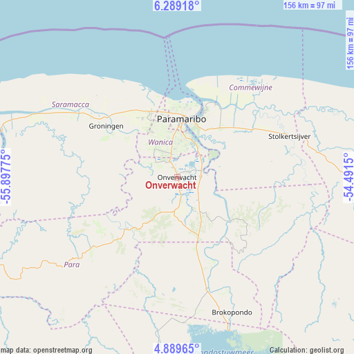
Onverwacht GPS coordinates[2]
5° 35' 23.388" North, 55° 11' 40.632" West
| Map corner | latitude | longitude |
|---|---|---|
| Upper-left | 6.28918°, | -55.89775° |
| Center: | 5.58983°, | -55.19462° |
| Lower-right: | 4.88965°, | -54.4915° |
| Map W x H: | 155.6×155.6 km | = 96.7×96.7mi |
| max Lat: | 5.92606° ⇑69.2% North |
| Onverwacht: | 5.58983° |
| min Lat: | ⇓30.8% South 3.67207° |
| min Long | Onverwacht | max Long |
| -56.97297° | -55.19462° | -54.05522° |
| W 38.5%⇐ | ⇒61.5% E |
Elevation
Elevation of Onverwacht is 7 m = 23 ft, and this is 11.9 m = 39 ft below average elevation for this country.
| Max E: |
99 m = 325 ft | 61.5% |
| Avg. | 18.9 m = 62 ft | |
| Onverwacht | 7 m = 23 ft | |
Min E: |
1 m = 3 ft | 38.5% |
See also: Suriname elevation on elevation.city.
Geographical zone
Onverwacht is located in North Torrid zone (between Equator and Tropic of Cancer). Distance of Equator is 621.5 km =386.2 mi to South.| Distance of | km | miles | from Onverwacht |
|---|---|---|---|
| North Pole | 9385.5 | 5831.9 | to North |
| Arctic Circle | 6779.6 | 4212.6 | to North |
| Tropic Cancer | 1984.4 | 1233 | to North |
| Equator | 621.5 | 386.2 | to South |


Nearby cities:
13 places around Onverwacht: (largest is in red/bold)
• Albina
126.5 km =78.6 mi,  94°
94°
• Benzdorp (Monte Hermon)
245.1 km =152.3 mi,  150°
150°
• Brokopondo
63.9 km =39.7 mi,  158°
158°
• Brownsweg
65.3 km =40.6 mi,  175°
175°
• Groningen
38.1 km =23.7 mi,  307°
307°
• Lelydorp
13 km =8.1 mi,  340°
340°
• Mariënburg
36.1 km =22.4 mi,  27°
27°
• Moengo
87.8 km =54.6 mi, 88°
• Nieuw Amsterdam
34.9 km =21.7 mi,  19°
19°
• Nieuw Nickerie
200.3 km =124.5 mi,  280°
280°
• Paramaribo
30.9 km =19.2 mi,  5°
5°
• Totness
129.1 km =80.2 mi, 284°
• Wageningen
163.8 km =101.8 mi, 276°
Sources, notices
• [Note1] Compared only with cities in Suriname existing in our database
• [Src1] Map data: © OpenStreetMap contributors (CC-BY-SA)
• [Src2] Other city data from geonames.org with taken over terms of usage.
• [Src3] Geographical zone / Annual Mean Temperature by Robert A. Rohde @ Wikipedia
