Lelydorp geodata
Lelydorp (Wanica) is a seat of a first-order administrative division; located in Suriname in America/Paramaribo (GMT-3) time zone. With population of 18,223 people, there is 1 city with bigger population in this country. Compared to other cities in Suriname, 53.8% of cities are located further ↑North; 69.2% of cities are located further →East and 53.8% of cities have higher elevation than Lelydorp. Note1


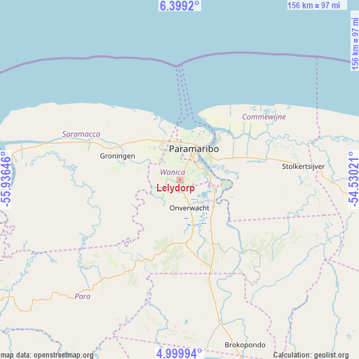
Lelydorp GPS coordinates[2]
5° 42' 0" North, 55° 13' 59.988" West
| Map corner | latitude | longitude |
|---|---|---|
| Upper-left | 6.3992°, | -55.93646° |
| Center: | 5.7°, | -55.23333° |
| Lower-right: | 4.99994°, | -54.53021° |
| Map W x H: | 155.6×155.6 km | = 96.7×96.7mi |
| max Lat: | 5.92606° ⇑53.8% North |
| Lelydorp: | 5.7° |
| min Lat: | ⇓46.2% South 3.67207° |
| min Long | Lelydorp | max Long |
| -56.97297° | -55.23333° | -54.05522° |
| W 30.8%⇐ | ⇒69.2% E |
Elevation
Elevation of Lelydorp is 8 m = 26 ft, and this is 10.9 m = 36 ft below average elevation for this country.
| Max E: |
99 m = 325 ft | 53.8% |
| Avg. | 18.9 m = 62 ft | |
| Lelydorp | 8 m = 26 ft | |
Min E: |
1 m = 3 ft | 46.2% |
See also: Suriname elevation on elevation.city.
Geographical zone
Lelydorp is located in North Torrid zone (between Equator and Tropic of Cancer). Distance of Equator is 633.8 km =393.8 mi to South.| Distance of | km | miles | from Lelydorp |
|---|---|---|---|
| North Pole | 9373.3 | 5824.3 | to North |
| Arctic Circle | 6767.4 | 4205.1 | to North |
| Tropic Cancer | 1972.1 | 1225.4 | to North |
| Equator | 633.8 | 393.8 | to South |


Nearby cities:
13 places around Lelydorp: (largest is in red/bold)
• Albina
132.3 km =82.2 mi,  99°
99°
• Benzdorp (Monte Hermon)
257.9 km =160.3 mi,  150°
150°
• Brokopondo
76.9 km =47.8 mi,  158°
158°
• Brownsweg
77.9 km =48.4 mi,  173°
173°
• Groningen
28.1 km =17.5 mi,  293°
293°
• Mariënburg
28.8 km =17.9 mi,  46°
46°
• Moengo
92.6 km =57.5 mi, 95°
• Nieuw Amsterdam
26.1 km =16.2 mi,  37°
37°
• Nieuw Nickerie
194.1 km =120.6 mi,  277°
277°
• Onverwacht
13 km =8.1 mi, 160°
• Paramaribo
19.9 km =12.4 mi,  21°
21°
• Totness
122.4 km =76.1 mi, 279°
• Wageningen
158.6 km =98.5 mi,  272°
272°
Sources, notices
• [Note1] Compared only with cities in Suriname existing in our database
• [Src1] Map data: © OpenStreetMap contributors (CC-BY-SA)
• [Src2] Other city data from geonames.org with taken over terms of usage.
• [Src3] Geographical zone / Annual Mean Temperature by Robert A. Rohde @ Wikipedia
