Moengo geodata
Moengo (Marowijne) is a populated place; located in Suriname in America/Paramaribo (GMT-3) time zone. With population of 7,074 people, there are 4 cities with bigger population in this country. Compared to other cities in Suriname, 61.5% of cities are located further ↑North; 84.6% of cities are located further ←West and 53.8% of cities have lower elevation than Moengo. Note1


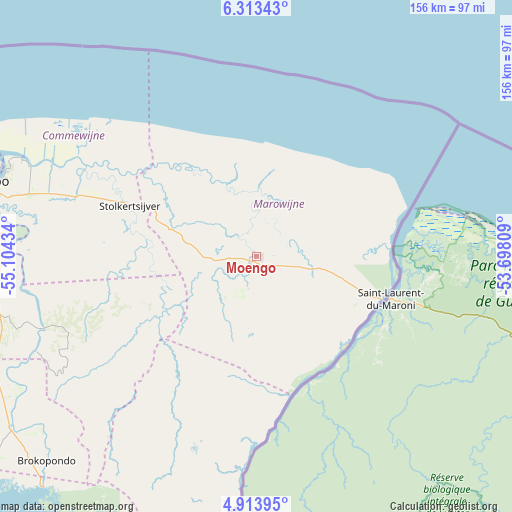
Moengo GPS coordinates[2]
5° 36' 50.796" North, 54° 24' 4.356" West
| Map corner | latitude | longitude |
|---|---|---|
| Upper-left | 6.31343°, | -55.10434° |
| Center: | 5.61411°, | -54.40121° |
| Lower-right: | 4.91395°, | -53.69809° |
| Map W x H: | 155.6×155.6 km | = 96.7×96.7mi |
| max Lat: | 5.92606° ⇑61.5% North |
| Moengo: | 5.61411° |
| min Lat: | ⇓38.5% South 3.67207° |
| min Long | Moengo | max Long |
| -56.97297° | -54.40121° | -54.05522° |
| W 84.6%⇐ | ⇒15.4% E |
Elevation
Elevation of Moengo is 9 m = 30 ft, and this is 9.9 m = 32 ft below average elevation for this country.
| Max E: |
99 m = 325 ft | 46.2% |
| Avg. | 18.9 m = 62 ft | |
| Moengo | 9 m = 30 ft | |
Min E: |
1 m = 3 ft | 53.8% |
See also: Suriname elevation on elevation.city.
Geographical zone
Moengo is located in North Torrid zone (between Equator and Tropic of Cancer). Distance of Equator is 624.2 km =387.9 mi to South.| Distance of | km | miles | from Moengo |
|---|---|---|---|
| North Pole | 9382.8 | 5830.2 | to North |
| Arctic Circle | 6776.9 | 4211 | to North |
| Tropic Cancer | 1981.7 | 1231.4 | to North |
| Equator | 624.2 | 387.9 | to South |


Nearby cities:
13 places around Moengo: (largest is in red/bold)
• Albina
40.4 km =25.1 mi,  108°
108°
• Benzdorp (Monte Hermon)
218.4 km =135.7 mi,  171°
171°
• Brokopondo
89.2 km =55.4 mi,  225°
225°
• Brownsweg
107.4 km =66.7 mi, 230°
• Groningen
119.7 km =74.4 mi,  279°
279°
• Lelydorp
92.6 km =57.5 mi, 275°
• Mariënburg
76.8 km =47.7 mi,  292°
292°
• Nieuw Amsterdam
81.8 km =50.8 mi, 291°
• Nieuw Nickerie
286.6 km =178.1 mi, 276°
• Onverwacht
87.8 km =54.6 mi,  268°
268°
• Paramaribo
89.2 km =55.4 mi, 288°
• Totness
214.9 km =133.5 mi, 277°
• Wageningen
251 km =156 mi, 273°
Sources, notices
• [Note1] Compared only with cities in Suriname existing in our database
• [Src1] Map data: © OpenStreetMap contributors (CC-BY-SA)
• [Src2] Other city data from geonames.org with taken over terms of usage.
• [Src3] Geographical zone / Annual Mean Temperature by Robert A. Rohde @ Wikipedia
