Mariënburg geodata
Mariënburg (Commewijne) is a populated place; located in Suriname in America/Paramaribo (GMT-3) time zone. With population of 4,427 people, there are 6 cities with bigger population in this country. Compared to other cities in Suriname, 84.6% of cities are located further ↓South; 69.2% of cities are located further ←West and 100% of cities have higher elevation than Mariënburg. Note1


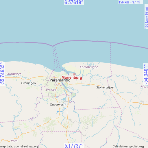
Mariënburg GPS coordinates[2]
5° 52' 37.992" North, 55° 2' 35.592" West
| Map corner | latitude | longitude |
|---|---|---|
| Upper-left | 6.57619°, | -55.74635° |
| Center: | 5.87722°, | -55.04322° |
| Lower-right: | 5.17737°, | -54.3401° |
| Map W x H: | 155.5×155.5 km | = 96.6×96.6mi |
| max Lat: | 5.92606° ⇑15.4% North |
| Mariënburg: | 5.87722° |
| min Lat: | ⇓84.6% South 3.67207° |
| min Long | Mariënburg | max Long |
| -56.97297° | -55.04322° | -54.05522° |
| W 69.2%⇐ | ⇒30.8% E |
Elevation
Elevation of Mariënburg is 1 m = 3 ft, and this is 17.9 m = 59 ft below average elevation for this country.
| Max E: |
99 m = 325 ft | 100% |
| Avg. | 18.9 m = 62 ft | |
| Mariënburg | 1 m = 3 ft | |
Min E: |
1 m = 3 ft | 0% |
See also: Suriname elevation on elevation.city.
Geographical zone
Mariënburg is located in North Torrid zone (between Equator and Tropic of Cancer). Distance of Equator is 653.5 km =406.1 mi to South.| Distance of | km | miles | from Mariënburg |
|---|---|---|---|
| North Pole | 9353.6 | 5812.1 | to North |
| Arctic Circle | 6747.7 | 4192.8 | to North |
| Tropic Cancer | 1952.4 | 1213.2 | to North |
| Equator | 653.5 | 406.1 | to South |


Nearby cities:
13 places around Mariënburg: (largest is in red/bold)
• Albina
117.2 km =72.8 mi,  111°
111°
• Benzdorp (Monte Hermon)
266.4 km =165.5 mi,  156°
156°
• Brokopondo
91.6 km =56.9 mi,  175°
175°
• Brownsweg
97.8 km =60.8 mi,  187°
187°
• Groningen
47.6 km =29.6 mi,  259°
259°
• Lelydorp
28.8 km =17.9 mi,  226°
226°
• Moengo
76.8 km =47.7 mi, 112°
• Nieuw Amsterdam
5.1 km =3.2 mi,  280°
280°
• Nieuw Nickerie
213.5 km =132.7 mi,  271°
271°
• Onverwacht
36.1 km =22.4 mi,  207°
207°
• Paramaribo
13.7 km =8.5 mi, 264°
• Totness
141.9 km =88.2 mi, 269°
• Wageningen
179.9 km =111.8 mi, 265°
Sources, notices
• [Note1] Compared only with cities in Suriname existing in our database
• [Src1] Map data: © OpenStreetMap contributors (CC-BY-SA)
• [Src2] Other city data from geonames.org with taken over terms of usage.
• [Src3] Geographical zone / Annual Mean Temperature by Robert A. Rohde @ Wikipedia
