Delgado geodata
Delgado (San Salvador) is a populated place; located in El Salvador in America/El_Salvador (GMT-6) time zone. With population of 71,594 people, there are 7 cities with bigger population in this country. Compared to other cities in El Salvador, 54% of cities are located further ↓South; 57% of cities are located further →East and 68% of cities have lower elevation than Delgado. Note1


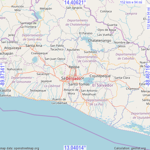
Delgado GPS coordinates[2]
13° 43' 27.012" North, 89° 10' 13.008" West
| Map corner | latitude | longitude |
|---|---|---|
| Upper-left | 14.40621°, | -89.87341° |
| Center: | 13.72417°, | -89.17028° |
| Lower-right: | 13.04014°, | -88.46716° |
| Map W x H: | 151.9×151.9 km | = 94.4×94.4mi |
| max Lat: | 14.33333° ⇑46% North |
| Delgado: | 13.72417° |
| min Lat: | ⇓54% South 13.19694° |
| min Long | Delgado | max Long |
| -90.01583° | -89.17028° | -87.83861° |
| W 43%⇐ | ⇒57% E |
Elevation
Elevation of Delgado is 632 m = 2073 ft, and this is 160.1 m = 525 ft above average elevation for this country.
| Max E: |
1255 m = 4117 ft | 32% |
| Delgado | 632 m 2073 ft | |
| Avg. | 471.9 m = 1548 ft | |
Min E: |
13 m = 43 ft | 68% |
See also: Delgado elevation on elevation.city.
Geographical zone
Delgado is located in North Torrid zone (between Equator and Tropic of Cancer). Distance of this Northern Tropic circle is 1079.9 km =671 mi to North.| Distance of | km | miles | from Delgado |
|---|---|---|---|
| North Pole | 8481.1 | 5269.9 | to North |
| Arctic Circle | 5875.2 | 3650.7 | to North |
| Tropic Cancer | 1079.9 | 671 | to North |
| Equator | 1526 | 948.2 | to South |


Nearby cities:
15 places around Delgado: (largest is in red/bold)
• Antiguo Cuscatlán
11.1 km =6.9 mi,  233°
233°
• Apopa
9.3 km =5.8 mi,  354°
354°
• Ayutuxtepeque
4.6 km =2.9 mi,  301°
301°
• Cuscatancingo
1.8 km =1.1 mi,  317°
317°
• Ilopango
7 km =4.3 mi,  110°
110°
• Mejicanos
5 km =3.1 mi,  291°
291°
• Nuevo Cuscatlán
13.3 km =8.3 mi, 230°
• Panchimalco
12.4 km =7.7 mi,  184°
184°
• Quezaltepeque
16.2 km =10.1 mi, 317°
• San Marcos
7.4 km =4.6 mi,  190°
190°
• San Salvador
4.3 km =2.7 mi,  205°
205°
• Santa Tecla
12.9 km =8 mi,  246°
246°
• Santo Tomás
10.1 km =6.3 mi,  156°
156°
• Soyapango
3.6 km =2.2 mi,  115°
115°
• Tonacatepeque
8.4 km =5.2 mi,  41°
41°
Sources, notices
• [Note1] Compared only with cities in El Salvador existing in our database
• [Src1] Map data: © OpenStreetMap contributors (CC-BY-SA)
• [Src2] Other city data from geonames.org with taken over terms of usage.
• [Src3] Geographical zone / Annual Mean Temperature by Robert A. Rohde @ Wikipedia
