Atiquizaya geodata
Atiquizaya (Ahuachapán) is a populated place; located in El Salvador in America/El_Salvador (GMT-6) time zone. With population of 9,476 people, there are 47 cities with bigger population in this country. Compared to other cities in El Salvador, 92% of cities are located further ↓South; 93% of cities are located further →East and 63% of cities have lower elevation than Atiquizaya. Note1


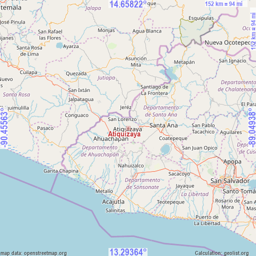
Atiquizaya GPS coordinates[2]
13° 58' 36.984" North, 89° 45' 9" West
| Map corner | latitude | longitude |
|---|---|---|
| Upper-left | 14.65822°, | -90.45563° |
| Center: | 13.97694°, | -89.7525° |
| Lower-right: | 13.29364°, | -89.04938° |
| Map W x H: | 151.7×151.7 km | = 94.3×94.3mi |
| max Lat: | 14.33333° ⇑8% North |
| Atiquizaya: | 13.97694° |
| min Lat: | ⇓92% South 13.19694° |
| min Long | Atiquizaya | max Long |
| -90.01583° | -89.7525° | -87.83861° |
| W 7%⇐ | ⇒93% E |
Elevation
Elevation of Atiquizaya is 615 m = 2018 ft, and this is 143.1 m = 469 ft above average elevation for this country.
| Max E: |
1255 m = 4117 ft | 37% |
| Atiquizaya | 615 m 2018 ft | |
| Avg. | 471.9 m = 1548 ft | |
Min E: |
13 m = 43 ft | 63% |
See also: El Salvador elevation on elevation.city.
Geographical zone
Atiquizaya is located in North Torrid zone (between Equator and Tropic of Cancer). Distance of this Northern Tropic circle is 1051.8 km =653.6 mi to North.| Distance of | km | miles | from Atiquizaya |
|---|---|---|---|
| North Pole | 8453 | 5252.4 | to North |
| Arctic Circle | 5847.1 | 3633.2 | to North |
| Tropic Cancer | 1051.8 | 653.6 | to North |
| Equator | 1554.1 | 965.7 | to South |


Nearby cities:
15 places around Atiquizaya: (largest is in red/bold)
• Ahuachapán
11.7 km =7.3 mi,  238°
238°
• Candelaria de La Frontera
19.1 km =11.9 mi,  35°
35°
• Chalchuapa
7.8 km =4.8 mi,  82°
82°
• Coatepeque
27.3 km =17 mi,  101°
101°
• Concepción de Ataco
15.8 km =9.8 mi,  221°
221°
• El Congo
28.7 km =17.8 mi,  105°
105°
• Guaymango
27 km =16.8 mi,  201°
201°
• Izalco
27.2 km =16.9 mi,  161°
161°
• Juayúa
15.1 km =9.4 mi,  177°
177°
• Jujutla
24 km =14.9 mi,  208°
208°
• Nahuizalco
22.2 km =13.8 mi, 175°
• Santa Ana
20.9 km =13 mi, 84°
• Sonsonate
28.9 km =18 mi,  173°
173°
• Sonzacate
27.3 km =17 mi, 171°
• Tacuba
20.9 km =13 mi,  246°
246°
Sources, notices
• [Note1] Compared only with cities in El Salvador existing in our database
• [Src1] Map data: © OpenStreetMap contributors (CC-BY-SA)
• [Src2] Other city data from geonames.org with taken over terms of usage.
• [Src3] Geographical zone / Annual Mean Temperature by Robert A. Rohde @ Wikipedia
