Ahuachapán geodata
Ahuachapán is a seat of a first-order administrative division; located in El Salvador in America/El_Salvador (GMT-6) time zone. With population of 34,102 people, there are 17 cities with bigger population in this country. Compared to other cities in El Salvador, 85% of cities are located further ↓South; 96% of cities are located further →East and 88% of cities have lower elevation than Ahuachapán. Note1


Ahuachapán GPS coordinates[2]
13° 55' 17.004" North, 89° 50' 42" West
| Map corner | latitude | longitude |
|---|---|---|
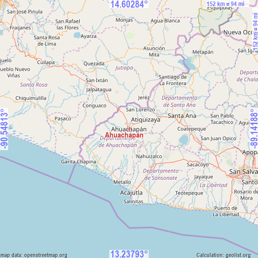
| Upper-left | 14.60284°, | -90.54813° |
| Center: | 13.92139°, | -89.845° |
| Lower-right: | 13.23793°, | -89.14188° |
| Map W x H: | 151.8×151.8 km | = 94.3×94.3mi |
| max Lat: | 14.33333° ⇑15% North |
| Ahuachapán: | 13.92139° |
| min Lat: | ⇓85% South 13.19694° |
| min Long | Ahuachapán | max Long |
| -90.01583° | -89.845° | -87.83861° |
| W 4%⇐ | ⇒96% E |
Elevation
Elevation of Ahuachapán is 796 m = 2612 ft, and this is 324.1 m = 1063 ft above average elevation for this country.
| Max E: |
1255 m = 4117 ft | 12% |
| Ahuachapán | 796 m 2612 ft | |
| Avg. | 471.9 m = 1548 ft | |
Min E: |
13 m = 43 ft | 88% |
See also: El Salvador elevation on elevation.city.
Geographical zone
Ahuachapán is located in North Torrid zone (between Equator and Tropic of Cancer). Distance of this Northern Tropic circle is 1058 km =657.4 mi to North.| Distance of | km | miles | from Ahuachapán |
|---|---|---|---|
| North Pole | 8459.1 | 5256.2 | to North |
| Arctic Circle | 5853.3 | 3637.1 | to North |
| Tropic Cancer | 1058 | 657.4 | to North |
| Equator | 1547.9 | 961.8 | to South |


Nearby cities:
15 places around Ahuachapán: (largest is in red/bold)
• Atiquizaya
11.7 km =7.3 mi,  58°
58°
• Candelaria de La Frontera
30.2 km =18.8 mi,  44°
44°
• Chalchuapa
19.1 km =11.9 mi,  67°
67°
• Concepción de Ataco
5.7 km =3.5 mi,  183°
183°
• Guaymango
19 km =11.8 mi, 179°
• Izalco
27 km =16.8 mi,  136°
136°
• Juayúa
13.9 km =8.6 mi,  129°
129°
• Jujutla
15 km =9.3 mi,  185°
185°
• Nahuizalco
19.8 km =12.3 mi, 143°
• San Antonio del Monte
25.5 km =15.8 mi,  153°
153°
• San Francisco Menéndez
20.4 km =12.7 mi,  244°
244°
• Santa Ana
31.8 km =19.8 mi,  75°
75°
• Sonsonate
26 km =16.2 mi, 149°
• Sonzacate
25.1 km =15.6 mi, 145°
• Tacuba
9.4 km =5.8 mi,  256°
256°
Sources, notices
• [Note1] Compared only with cities in El Salvador existing in our database
• [Src1] Map data: © OpenStreetMap contributors (CC-BY-SA)
• [Src2] Other city data from geonames.org with taken over terms of usage.
• [Src3] Geographical zone / Annual Mean Temperature by Robert A. Rohde @ Wikipedia
