Qal‘at al Maḑīq geodata
Qal‘at al Maḑīq (Hama) is a seat of a third-order administrative division; located in Syria in Asia/Damascus (GMT+3) time zone. In our database, there are 87 cities with bigger population. Compared to other cities in Syria, 60.1% of cities are located further ↓South; 62.9% of cities are located further →East and 94% of cities have higher elevation than Qal‘at al Maḑīq. Note1


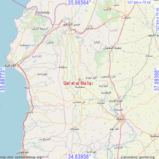
Qal‘at al Maḑīq GPS coordinates[2]
35° 24' 52.74" North, 36° 23' 27.06" East
| Map corner | latitude | longitude |
|---|---|---|
| Upper-left | 35.98564°, | 35.68773° |
| Center: | 35.41465°, | 36.39085° |
| Lower-right: | 34.83958°, | 37.09398° |
| Map W x H: | 127.4×127.4 km | = 79.2×79.2mi |
| max Lat: | 37.17701° ⇑39.9% North |
| Qal‘at al Maḑīq: | 35.41465° |
| min Lat: | ⇓60.1% South 32.39332° |
| min Long | Qal‘at al Ma� | max Long |
| 35.75572° | 36.39085° | 42.14006° |
| W 37.1%⇐ | ⇒62.9% E |
Elevation
Elevation of Qal‘at al Maḑīq is 177 m = 581 ft, and this is 352.1 m = 1155 ft below average elevation for this country.
| Max E: |
1640 m = 5381 ft | 94% |
| Avg. | 529.1 m = 1736 ft | |
| Qal‘at al Maḑīq | 177 m = 581 ft | |
Min E: |
4 m = 13 ft | 6% |
See also: Syria elevation on elevation.city.
Geographical zone
Qal‘at al Maḑīq is located in North temperate zone (between Tropic of Cancer and the Arctic Circle). Distance of this Northern Tropic circle is 1331.8 km =827.5 mi to South.| Distance of | km | miles | from Qal‘at al Maḑīq |
|---|---|---|---|
| North Pole | 6069.3 | 3771.3 | to North |
| Arctic Circle | 3463.4 | 2152.1 | to North |
| Tropic Cancer | 1331.8 | 827.5 | to South |
| Equator | 3937.7 | 2446.8 | to South |


Nearby cities:
15 places around Qal‘at al Maḑīq: (largest is in red/bold)
• As Suqaylibīyah
5.3 km =3.3 mi,  177°
177°
• Jawbat Burghāl
21.3 km =13.2 mi,  293°
293°
• Jubb Ramlah
23.1 km =14.4 mi,  170°
170°
• Kafr Zaytā
19.8 km =12.3 mi,  103°
103°
• Kafranbel
27.1 km =16.8 mi,  35°
35°
• Khān Shaykhūn
23.8 km =14.8 mi,  82°
82°
• Kurnāz
9.2 km =5.7 mi,  107°
107°
• Muḩradah
24.8 km =15.4 mi,  138°
138°
• Mūrak
27.4 km =17 mi, 98°
• Shaţḩah
16.7 km =10.4 mi,  307°
307°
• Tall Salḩab
17.3 km =10.7 mi, 181°
• Tremseh
18.9 km =11.7 mi,  147°
147°
• Ḩalfāyā
26 km =16.2 mi,  131°
131°
• Ḩarf al Musaytirah
23.4 km =14.5 mi,  262°
262°
• Ḩīsh
27.3 km =17 mi,  57°
57°
Sources, notices
• [Note1] Compared only with cities in Syria existing in our database
• [Src1] Map data: © OpenStreetMap contributors (CC-BY-SA)
• [Src2] Other city data from geonames.org with taken over terms of usage.
• [Src3] Geographical zone / Annual Mean Temperature by Robert A. Rohde @ Wikipedia
