Mūrak geodata
Mūrak (Hama) is a populated place; located in Syria in Asia/Damascus (GMT+3) time zone. With population of 14,307 people, there are 75 cities with bigger population in this country. Compared to other cities in Syria, 58.7% of cities are located further ↓South; 56.5% of cities are located further ←West and 66.4% of cities have higher elevation than Mūrak. Note1


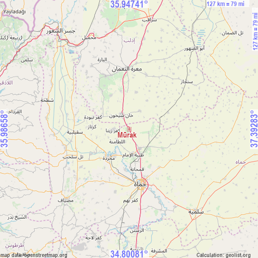
Mūrak GPS coordinates[2]
35° 22' 34.14" North, 36° 41' 22.92" East
| Map corner | latitude | longitude |
|---|---|---|
| Upper-left | 35.94741°, | 35.98658° |
| Center: | 35.37615°, | 36.6897° |
| Lower-right: | 34.80081°, | 37.39283° |
| Map W x H: | 127.5×127.5 km | = 79.2×79.2mi |
| max Lat: | 37.17701° ⇑41.3% North |
| Mūrak: | 35.37615° |
| min Lat: | ⇓58.7% South 32.39332° |
| min Long | Mūrak | max Long |
| 35.75572° | 36.6897° | 42.14006° |
| W 56.5%⇐ | ⇒43.5% E |
Elevation
Elevation of Mūrak is 374 m = 1227 ft, and this is 155.1 m = 509 ft below average elevation for this country.
| Max E: |
1640 m = 5381 ft | 66.4% |
| Avg. | 529.1 m = 1736 ft | |
| Mūrak | 374 m = 1227 ft | |
Min E: |
4 m = 13 ft | 33.6% |
See also: Syria elevation on elevation.city.
Geographical zone
Mūrak is located in North temperate zone (between Tropic of Cancer and the Arctic Circle). Distance of this Northern Tropic circle is 1327.5 km =824.9 mi to South.| Distance of | km | miles | from Mūrak |
|---|---|---|---|
| North Pole | 6073.6 | 3774 | to North |
| Arctic Circle | 3467.7 | 2154.7 | to North |
| Tropic Cancer | 1327.5 | 824.9 | to South |
| Equator | 3933.5 | 2444.2 | to South |


Nearby cities:
15 places around Mūrak: (largest is in red/bold)
• As Suqaylibīyah
26.9 km =16.7 mi,  267°
267°
• At Tamāni‘ah
10.6 km =6.6 mi,  30°
30°
• Jubb Ramlah
29.9 km =18.6 mi,  231°
231°
• Kafr Zaytā
7.8 km =4.8 mi, 268°
• Kafranbel
28.7 km =17.8 mi,  336°
336°
• Khān Shaykhūn
8.1 km =5 mi,  334°
334°
• Kurnāz
18.4 km =11.4 mi, 274°
• Muḩradah
17.8 km =11.1 mi,  216°
216°
• Qal‘at al Maḑīq
27.4 km =17 mi,  278°
278°
• Souran
10.8 km =6.7 mi,  150°
150°
• Tremseh
20.5 km =12.7 mi,  235°
235°
• Ţayyibat al Imām
12.4 km =7.7 mi,  170°
170°
• Ḩalfāyā
15 km =9.3 mi,  210°
210°
• Ḩamāh
27.9 km =17.3 mi, 167°
• Ḩīsh
19.6 km =12.2 mi,  347°
347°
Sources, notices
• [Note1] Compared only with cities in Syria existing in our database
• [Src1] Map data: © OpenStreetMap contributors (CC-BY-SA)
• [Src2] Other city data from geonames.org with taken over terms of usage.
• [Src3] Geographical zone / Annual Mean Temperature by Robert A. Rohde @ Wikipedia
