Jisr ash Shughūr geodata
Jisr ash Shughūr (Idlib) is a seat of a second-order administrative division; located in Syria in Asia/Damascus (GMT+3) time zone. With population of 39,311 people, there are 34 cities with bigger population in this country. Compared to other cities in Syria, 72.1% of cities are located further ↓South; 68.2% of cities are located further →East and 96.5% of cities have higher elevation than Jisr ash Shughūr. Note1


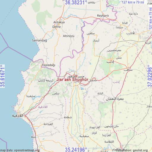
Jisr ash Shughūr GPS coordinates[2]
35° 48' 51.048" North, 36° 19' 11.388" East
| Map corner | latitude | longitude |
|---|---|---|
| Upper-left | 36.38231°, | 35.61671° |
| Center: | 35.81418°, | 36.31983° |
| Lower-right: | 35.24196°, | 37.02296° |
| Map W x H: | 126.8×126.8 km | = 78.8×78.8mi |
| max Lat: | 37.17701° ⇑27.9% North |
| Jisr ash Shughūr: | 35.81418° |
| min Lat: | ⇓72.1% South 32.39332° |
| min Long | Jisr ash Shugh� | max Long |
| 35.75572° | 36.31983° | 42.14006° |
| W 31.8%⇐ | ⇒68.2% E |
Elevation
Elevation of Jisr ash Shughūr is 163 m = 535 ft, and this is 366.1 m = 1201 ft below average elevation for this country.
| Max E: |
1640 m = 5381 ft | 96.5% |
| Avg. | 529.1 m = 1736 ft | |
| Jisr ash Shughūr | 163 m = 535 ft | |
Min E: |
4 m = 13 ft | 3.5% |
See also: Syria elevation on elevation.city.
Geographical zone
Jisr ash Shughūr is located in North temperate zone (between Tropic of Cancer and the Arctic Circle). Distance of this Northern Tropic circle is 1376.2 km =855.1 mi to South.| Distance of | km | miles | from Jisr ash Shughūr |
|---|---|---|---|
| North Pole | 6024.9 | 3743.7 | to North |
| Arctic Circle | 3419 | 2124.5 | to North |
| Tropic Cancer | 1376.2 | 855.1 | to South |
| Equator | 3982.2 | 2474.4 | to South |


Nearby cities:
15 places around Jisr ash Shughūr: (largest is in red/bold)
• Al Jānūdīyah
8.3 km =5.2 mi,  341°
341°
• Arīḩā
26.1 km =16.2 mi,  90°
90°
• Az Ziyārah
14.5 km =9 mi,  173°
173°
• Bdāmā
11.1 km =6.9 mi,  268°
268°
• Darkūsh
20.8 km =12.9 mi,  18°
18°
• Idlib
31.1 km =19.3 mi,  65°
65°
• Iḩsim
23.7 km =14.7 mi,  115°
115°
• Kafranbel
31.4 km =19.5 mi,  135°
135°
• Kassab
32.3 km =20.1 mi,  292°
292°
• Kinnsibbā
16.1 km =10 mi,  240°
240°
• Muḩambal
14.1 km =8.8 mi,  102°
102°
• Qasţal Ma‘āf
33.2 km =20.6 mi, 271°
• Rabī‘ah
25.6 km =15.9 mi,  263°
263°
• Şlinfah
26.8 km =16.7 mi,  206°
206°
• ‘Ayn at Tīnah
34.1 km =21.2 mi,  215°
215°
Sources, notices
• [Note1] Compared only with cities in Syria existing in our database
• [Src1] Map data: © OpenStreetMap contributors (CC-BY-SA)
• [Src2] Other city data from geonames.org with taken over terms of usage.
• [Src3] Geographical zone / Annual Mean Temperature by Robert A. Rohde @ Wikipedia
