Arīḩā geodata
Arīḩā (Idlib) is a seat of a second-order administrative division; located in Syria in Asia/Damascus (GMT+3) time zone. In our database, there are 87 cities with bigger population. Compared to other cities in Syria, 71.7% of cities are located further ↓South; 51.9% of cities are located further ←West and 67.5% of cities have lower elevation than Arīḩā. Note1


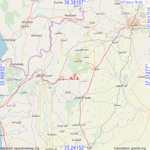
Arīḩā GPS coordinates[2]
35° 48' 49.464" North, 36° 36' 34.704" East
| Map corner | latitude | longitude |
|---|---|---|
| Upper-left | 36.38187°, | 35.90652° |
| Center: | 35.81374°, | 36.60964° |
| Lower-right: | 35.24152°, | 37.31277° |
| Map W x H: | 126.8×126.8 km | = 78.8×78.8mi |
| max Lat: | 37.17701° ⇑28.3% North |
| Arīḩā: | 35.81374° |
| min Lat: | ⇓71.7% South 32.39332° |
| min Long | Arīḩā | max Long |
| 35.75572° | 36.60964° | 42.14006° |
| W 51.9%⇐ | ⇒48.1% E |
Elevation
Elevation of Arīḩā is 598 m = 1962 ft, and this is 68.9 m = 226 ft above average elevation for this country.
| Max E: |
1640 m = 5381 ft | 32.5% |
| Arīḩā | 598 m 1962 ft | |
| Avg. | 529.1 m = 1736 ft | |
Min E: |
4 m = 13 ft | 67.5% |
See also: Syria elevation on elevation.city.
Geographical zone
Arīḩā is located in North temperate zone (between Tropic of Cancer and the Arctic Circle). Distance of this Northern Tropic circle is 1376.2 km =855.1 mi to South.| Distance of | km | miles | from Arīḩā |
|---|---|---|---|
| North Pole | 6024.9 | 3743.7 | to North |
| Arctic Circle | 3419.1 | 2124.5 | to North |
| Tropic Cancer | 1376.2 | 855.1 | to South |
| Equator | 3982.1 | 2474.4 | to South |


Nearby cities:
15 places around Arīḩā: (largest is in red/bold)
• Al Jānūdīyah
29.8 km =18.5 mi,  285°
285°
• Az Ziyārah
28.3 km =17.6 mi,  239°
239°
• Binnish
18.5 km =11.5 mi,  30°
30°
• Darkūsh
27.8 km =17.3 mi,  315°
315°
• Idlib
13.2 km =8.2 mi,  9°
9°
• Iḩsim
11.4 km =7.1 mi,  204°
204°
• Jisr ash Shughūr
26.1 km =16.2 mi,  270°
270°
• Kafranbel
22.6 km =14 mi,  190°
190°
• Ma‘arrat an Nu‘mān
19.4 km =12.1 mi,  161°
161°
• Ma‘arratmişrīn
22.7 km =14.1 mi, 14°
• Muḩambal
12.7 km =7.9 mi,  256°
256°
• Sarmīn
14.5 km =9 mi,  46°
46°
• Sarāqib
18.6 km =11.6 mi,  72°
72°
• Taftanāz
25.9 km =16.1 mi,  37°
37°
• Ḩīsh
29.7 km =18.5 mi,  174°
174°
Sources, notices
• [Note1] Compared only with cities in Syria existing in our database
• [Src1] Map data: © OpenStreetMap contributors (CC-BY-SA)
• [Src2] Other city data from geonames.org with taken over terms of usage.
• [Src3] Geographical zone / Annual Mean Temperature by Robert A. Rohde @ Wikipedia
