Dārayyā geodata
Dārayyā (Rif-dimashq) is a seat of a second-order administrative division; located in Syria in Asia/Damascus (GMT+3) time zone. With population of 71,596 people, there are 16 cities with bigger population in this country. Compared to other cities in Syria, 84.8% of cities are located further ↑North; 73.1% of cities are located further →East and 79.2% of cities have lower elevation than Dārayyā. Note1


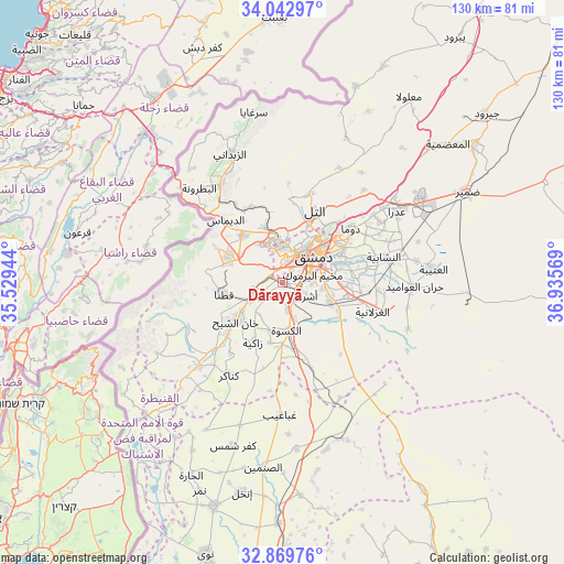
Dārayyā GPS coordinates[2]
33° 27' 30.06" North, 36° 13' 57.216" East
| Map corner | latitude | longitude |
|---|---|---|
| Upper-left | 34.04297°, | 35.52944° |
| Center: | 33.45835°, | 36.23256° |
| Lower-right: | 32.86976°, | 36.93569° |
| Map W x H: | 130.4×130.4 km | = 81×81mi |
| max Lat: | 37.17701° ⇑84.8% North |
| Dārayyā: | 33.45835° |
| min Lat: | ⇓15.2% South 32.39332° |
| min Long | Dārayyā | max Long |
| 35.75572° | 36.23256° | 42.14006° |
| W 26.9%⇐ | ⇒73.1% E |
Elevation
Elevation of Dārayyā is 703 m = 2306 ft, and this is 173.9 m = 571 ft above average elevation for this country.
| Max E: |
1640 m = 5381 ft | 20.8% |
| Dārayyā | 703 m 2306 ft | |
| Avg. | 529.1 m = 1736 ft | |
Min E: |
4 m = 13 ft | 79.2% |
See also: Dārayyā elevation on elevation.city.
Geographical zone
Dārayyā is located in North temperate zone (between Tropic of Cancer and the Arctic Circle). Distance of this Northern Tropic circle is 1114.3 km =692.4 mi to South.| Distance of | km | miles | from Dārayyā |
|---|---|---|---|
| North Pole | 6286.8 | 3906.4 | to North |
| Arctic Circle | 3681 | 2287.3 | to North |
| Tropic Cancer | 1114.3 | 692.4 | to South |
| Equator | 3720.2 | 2311.6 | to South |


Nearby cities:
15 places around Dārayyā: (largest is in red/bold)
• Al Kiswah
11.2 km =7 mi,  175°
175°
• Al Mulayḩah
13.6 km =8.5 mi,  77°
77°
• Al Ḩajar al Aswad
6.6 km =4.1 mi,  90°
90°
• At Tall
18.4 km =11.4 mi,  23°
23°
• Babīlā
9.2 km =5.7 mi, 81°
• Damascus
7.9 km =4.9 mi,  43°
43°
• Dayr al ‘Aşāfīr
17.4 km =10.8 mi, 87°
• Jaramānā
11 km =6.8 mi,  73°
73°
• Kafr Baţnā
14.3 km =8.9 mi, 65°
• Qadsayyā
10.1 km =6.3 mi,  351°
351°
• Qaţanā
14.4 km =8.9 mi,  260°
260°
• Sahnaiya
3.7 km =2.3 mi,  190°
190°
• Ḩarastā
16.6 km =10.3 mi,  47°
47°
• ‘Ayn al Fījah
18 km =11.2 mi, 345°
• ‘Irbīn
15.2 km =9.4 mi, 54°
Sources, notices
• [Note1] Compared only with cities in Syria existing in our database
• [Src1] Map data: © OpenStreetMap contributors (CC-BY-SA)
• [Src2] Other city data from geonames.org with taken over terms of usage.
• [Src3] Geographical zone / Annual Mean Temperature by Robert A. Rohde @ Wikipedia
