Al Ghizlānīyah geodata
Al Ghizlānīyah (Rif-dimashq) is a seat of a third-order administrative division; located in Syria in Asia/Damascus (GMT+3) time zone. In our database, there are 87 cities with bigger population. Compared to other cities in Syria, 86.6% of cities are located further ↑North; 58.7% of cities are located further →East and 69.6% of cities have lower elevation than Al Ghizlānīyah. Note1


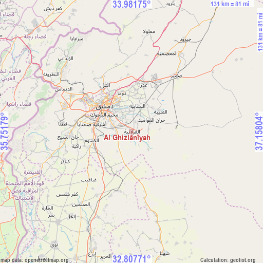
Al Ghizlānīyah GPS coordinates[2]
33° 23' 48.156" North, 36° 27' 17.676" East
| Map corner | latitude | longitude |
|---|---|---|
| Upper-left | 33.98175°, | 35.75179° |
| Center: | 33.39671°, | 36.45491° |
| Lower-right: | 32.80771°, | 37.15804° |
| Map W x H: | 130.5×130.5 km | = 81.1×81.1mi |
| max Lat: | 37.17701° ⇑86.6% North |
| Al Ghizlānīyah: | 33.39671° |
| min Lat: | ⇓13.4% South 32.39332° |
| min Long | Al Ghizlānīya | max Long |
| 35.75572° | 36.45491° | 42.14006° |
| W 41.3%⇐ | ⇒58.7% E |
Elevation
Elevation of Al Ghizlānīyah is 622 m = 2041 ft, and this is 92.9 m = 305 ft above average elevation for this country.
| Max E: |
1640 m = 5381 ft | 30.4% |
| Al Ghizlānīyah | 622 m 2041 ft | |
| Avg. | 529.1 m = 1736 ft | |
Min E: |
4 m = 13 ft | 69.6% |
See also: Syria elevation on elevation.city.
Geographical zone
Al Ghizlānīyah is located in North temperate zone (between Tropic of Cancer and the Arctic Circle). Distance of this Northern Tropic circle is 1107.4 km =688.1 mi to South.| Distance of | km | miles | from Al Ghizlānīyah |
|---|---|---|---|
| North Pole | 6293.7 | 3910.7 | to North |
| Arctic Circle | 3687.8 | 2291.5 | to North |
| Tropic Cancer | 1107.4 | 688.1 | to South |
| Equator | 3713.4 | 2307.4 | to South |


Nearby cities:
15 places around Al Ghizlānīyah: (largest is in red/bold)
• Al Kiswah
20.2 km =12.6 mi,  257°
257°
• Al Mulayḩah
12.3 km =7.6 mi,  323°
323°
• Al Ḩajar al Aswad
15.5 km =9.6 mi,  295°
295°
• An Nashābīyah
13 km =8.1 mi,  12°
12°
• Babīlā
14.2 km =8.8 mi,  305°
305°
• Damascus
19.7 km =12.2 mi, 309°
• Dayr al ‘Aşāfīr
8.3 km =5.2 mi,  337°
337°
• Douma
20.1 km =12.5 mi,  346°
346°
• Dārayyā
21.7 km =13.5 mi,  288°
288°
• Jaramānā
14.2 km =8.8 mi, 314°
• Kafr Baţnā
14.9 km =9.3 mi,  329°
329°
• Sahnaiya
21.5 km =13.4 mi,  278°
278°
• Ḩarastā
19.8 km =12.3 mi, 335°
• Ḩarrān al ‘Awāmīd
11.3 km =7 mi,  59°
59°
• ‘Irbīn
17.6 km =10.9 mi, 332°
Sources, notices
• [Note1] Compared only with cities in Syria existing in our database
• [Src1] Map data: © OpenStreetMap contributors (CC-BY-SA)
• [Src2] Other city data from geonames.org with taken over terms of usage.
• [Src3] Geographical zone / Annual Mean Temperature by Robert A. Rohde @ Wikipedia
