Al Kasrah geodata
Al Kasrah (Deir ez-Zor) is a seat of a third-order administrative division; located in Syria in Asia/Damascus (GMT+3) time zone. In our database, there are 87 cities with bigger population. Compared to other cities in Syria, 64.3% of cities are located further ↓South; 90.1% of cities are located further ←West and 83.4% of cities have higher elevation than Al Kasrah. Note1


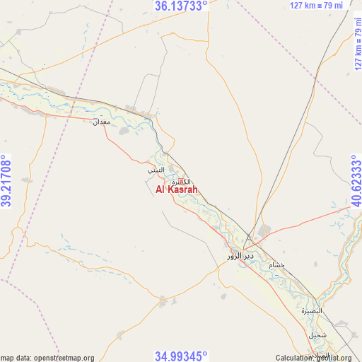
Al Kasrah GPS coordinates[2]
35° 34' 2.748" North, 39° 55' 12.72" East
| Map corner | latitude | longitude |
|---|---|---|
| Upper-left | 36.13733°, | 39.21708° |
| Center: | 35.56743°, | 39.9202° |
| Lower-right: | 34.99345°, | 40.62333° |
| Map W x H: | 127.2×127.2 km | = 79×79mi |
| max Lat: | 37.17701° ⇑35.7% North |
| Al Kasrah: | 35.56743° |
| min Lat: | ⇓64.3% South 32.39332° |
| min Long | Al Kasrah | max Long |
| 35.75572° | 39.9202° | 42.14006° |
| W 90.1%⇐ | ⇒9.9% E |
Elevation
Elevation of Al Kasrah is 246 m = 807 ft, and this is 283.1 m = 929 ft below average elevation for this country.
| Max E: |
1640 m = 5381 ft | 83.4% |
| Avg. | 529.1 m = 1736 ft | |
| Al Kasrah | 246 m = 807 ft | |
Min E: |
4 m = 13 ft | 16.6% |
See also: Syria elevation on elevation.city.
Geographical zone
Al Kasrah is located in North temperate zone (between Tropic of Cancer and the Arctic Circle). Distance of this Northern Tropic circle is 1348.8 km =838.1 mi to South.| Distance of | km | miles | from Al Kasrah |
|---|---|---|---|
| North Pole | 6052.3 | 3760.7 | to North |
| Arctic Circle | 3446.4 | 2141.5 | to North |
| Tropic Cancer | 1348.8 | 838.1 | to South |
| Equator | 3954.7 | 2457.3 | to South |


Nearby cities:
15 places around Al Kasrah: (largest is in red/bold)
• Al Buşayrah
64.8 km =40.3 mi,  134°
134°
• Al Karāmah
67 km =41.6 mi,  300°
300°
• Al Mayādīn
77.7 km =48.3 mi,  141°
141°
• Al ‘Ashārah
92.4 km =57.4 mi, 141°
• Ar Raqqah
92.8 km =57.7 mi, 297°
• As Sabkhah
65.3 km =40.6 mi,  294°
294°
• Ash Shaddādah
91.5 km =56.9 mi,  53°
53°
• At Tibnī
10.5 km =6.5 mi, 298°
• Deir ez-Zor
32.6 km =20.3 mi, 142°
• Dhībān
81.5 km =50.6 mi, 138°
• Khushām
44.7 km =27.8 mi, 131°
• Markadah
77.8 km =48.3 mi,  75°
75°
• Ma‘dān
35.8 km =22.2 mi,  305°
305°
• Mūḩ Ḩasan
51.7 km =32.1 mi, 135°
• Subaykhān
100.6 km =62.5 mi, 142°
Sources, notices
• [Note1] Compared only with cities in Syria existing in our database
• [Src1] Map data: © OpenStreetMap contributors (CC-BY-SA)
• [Src2] Other city data from geonames.org with taken over terms of usage.
• [Src3] Geographical zone / Annual Mean Temperature by Robert A. Rohde @ Wikipedia
