Ma‘dān geodata
Ma‘dān (Ar-Raqqah) is a seat of a third-order administrative division; located in Syria in Asia/Damascus (GMT+3) time zone. In our database, there are 87 cities with bigger population. Compared to other cities in Syria, 69.3% of cities are located further ↓South; 89.4% of cities are located further ←West and 86.9% of cities have higher elevation than Ma‘dān. Note1


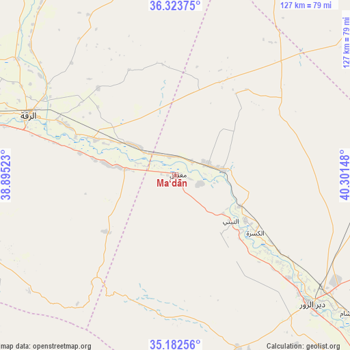
Ma‘dān GPS coordinates[2]
35° 45' 18.72" North, 39° 35' 54.06" East
| Map corner | latitude | longitude |
|---|---|---|
| Upper-left | 36.32375°, | 38.89523° |
| Center: | 35.7552°, | 39.59835° |
| Lower-right: | 35.18256°, | 40.30148° |
| Map W x H: | 126.9×126.9 km | = 78.9×78.9mi |
| max Lat: | 37.17701° ⇑30.7% North |
| Ma‘dān: | 35.7552° |
| min Lat: | ⇓69.3% South 32.39332° |
| min Long | Ma‘dān | max Long |
| 35.75572° | 39.59835° | 42.14006° |
| W 89.4%⇐ | ⇒10.6% E |
Elevation
Elevation of Ma‘dān is 226 m = 741 ft, and this is 303.1 m = 994 ft below average elevation for this country.
| Max E: |
1640 m = 5381 ft | 86.9% |
| Avg. | 529.1 m = 1736 ft | |
| Ma‘dān | 226 m = 741 ft | |
Min E: |
4 m = 13 ft | 13.1% |
See also: Syria elevation on elevation.city.
Geographical zone
Ma‘dān is located in North temperate zone (between Tropic of Cancer and the Arctic Circle). Distance of this Northern Tropic circle is 1369.7 km =851.1 mi to South.| Distance of | km | miles | from Ma‘dān |
|---|---|---|---|
| North Pole | 6031.5 | 3747.8 | to North |
| Arctic Circle | 3425.6 | 2128.6 | to North |
| Tropic Cancer | 1369.7 | 851.1 | to South |
| Equator | 3975.6 | 2470.3 | to South |


Nearby cities:
15 places around Ma‘dān: (largest is in red/bold)
• Al Buşayrah
100.4 km =62.4 mi,  131°
131°
• Al Karāmah
31.5 km =19.6 mi,  293°
293°
• Al Kasrah
35.8 km =22.2 mi, 125°
• Al Manşūrah
77.7 km =48.3 mi,  276°
276°
• Ar Raqqah
57.6 km =35.8 mi, 292°
• As Sabkhah
30.9 km =19.2 mi, 281°
• Ash Shaddādah
107.7 km =66.9 mi,  71°
71°
• At Tibnī
25.5 km =15.8 mi, 128°
• Ath Thawrah
95.1 km =59.1 mi, 275°
• Deir ez-Zor
67.7 km =42.1 mi, 133°
• Khushām
80.4 km =50 mi, 128°
• Markadah
104.2 km =64.7 mi,  90°
90°
• Mūḩ Ḩasan
87.1 km =54.1 mi, 131°
• Sulūk
102.5 km =63.7 mi,  335°
335°
• ‘Ayn ‘Īsá
96.4 km =59.9 mi,  316°
316°
Sources, notices
• [Note1] Compared only with cities in Syria existing in our database
• [Src1] Map data: © OpenStreetMap contributors (CC-BY-SA)
• [Src2] Other city data from geonames.org with taken over terms of usage.
• [Src3] Geographical zone / Annual Mean Temperature by Robert A. Rohde @ Wikipedia
