Deir ez-Zor geodata
Deir ez-Zor is a seat of a first-order administrative division; located in Syria in Asia/Damascus (GMT+3) time zone. With population of 242,565 people, there are 5 cities with bigger population in this country. Compared to other cities in Syria, 57.2% of cities are located further ↓South; 90.8% of cities are located further ←West and 87.6% of cities have higher elevation than Deir ez-Zor. Note1


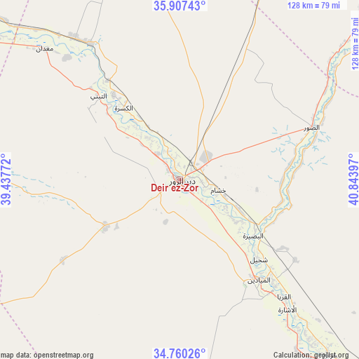
Deir ez-Zor GPS coordinates[2]
35° 20' 9.168" North, 40° 8' 27.024" East
| Map corner | latitude | longitude |
|---|---|---|
| Upper-left | 35.90743°, | 39.43772° |
| Center: | 35.33588°, | 40.14084° |
| Lower-right: | 34.76026°, | 40.84397° |
| Map W x H: | 127.6×127.6 km | = 79.3×79.3mi |
| max Lat: | 37.17701° ⇑42.8% North |
| Deir ez-Zor: | 35.33588° |
| min Lat: | ⇓57.2% South 32.39332° |
| min Long | Deir ez-Zor | max Long |
| 35.75572° | 40.14084° | 42.14006° |
| W 90.8%⇐ | ⇒9.2% E |
Elevation
Elevation of Deir ez-Zor is 210 m = 689 ft, and this is 319.1 m = 1047 ft below average elevation for this country.
| Max E: |
1640 m = 5381 ft | 87.6% |
| Avg. | 529.1 m = 1736 ft | |
| Deir ez-Zor | 210 m = 689 ft | |
Min E: |
4 m = 13 ft | 12.4% |
See also: Deir ez-Zor elevation on elevation.city.
Geographical zone
Deir ez-Zor is located in North temperate zone (between Tropic of Cancer and the Arctic Circle). Distance of this Northern Tropic circle is 1323.1 km =822.1 mi to South.| Distance of | km | miles | from Deir ez-Zor |
|---|---|---|---|
| North Pole | 6078.1 | 3776.8 | to North |
| Arctic Circle | 3472.2 | 2157.5 | to North |
| Tropic Cancer | 1323.1 | 822.1 | to South |
| Equator | 3929 | 2441.4 | to South |


Nearby cities:
15 places around Deir ez-Zor: (largest is in red/bold)
• Al Buşayrah
32.8 km =20.4 mi,  127°
127°
• Al Karāmah
97.9 km =60.8 mi,  307°
307°
• Al Kasrah
32.6 km =20.3 mi,  322°
322°
• Al Mayādīn
45.1 km =28 mi,  141°
141°
• Al ‘Ashārah
59.8 km =37.2 mi, 140°
• As Sabkhah
95.4 km =59.3 mi,  303°
303°
• Ash Shaddādah
96.5 km =60 mi,  33°
33°
• At Tibnī
42.4 km =26.3 mi, 316°
• Dhībān
49 km =30.4 mi, 136°
• Hajīn
95 km =59 mi, 138°
• Khushām
14 km =8.7 mi,  106°
106°
• Markadah
71.7 km =44.6 mi,  50°
50°
• Ma‘dān
67.7 km =42.1 mi, 313°
• Mūḩ Ḩasan
19.6 km =12.2 mi, 125°
• Subaykhān
68 km =42.3 mi, 142°
Sources, notices
• [Note1] Compared only with cities in Syria existing in our database
• [Src1] Map data: © OpenStreetMap contributors (CC-BY-SA)
• [Src2] Other city data from geonames.org with taken over terms of usage.
• [Src3] Geographical zone / Annual Mean Temperature by Robert A. Rohde @ Wikipedia
