Sawaengha geodata
Sawaengha (Ang Thong) is a seat of a second-order administrative division; located in Thailand in Asia/Bangkok (GMT+7) time zone. In our database, there are 331 cities with bigger population. Compared to other cities in Thailand, 54.2% of cities are located further ↑North; 63.7% of cities are located further →East and 75.3% of cities have higher elevation than Sawaengha. Note1


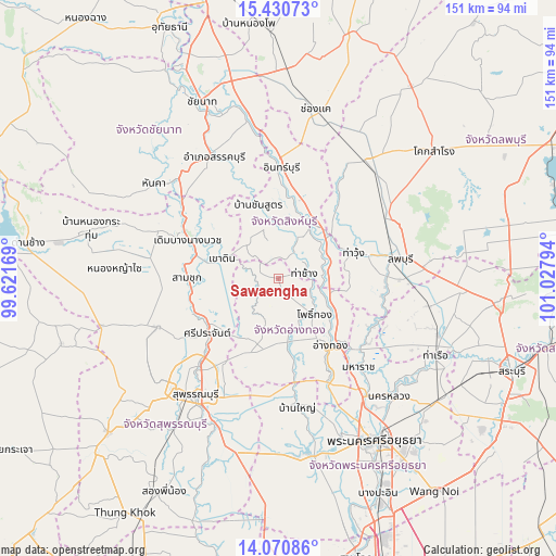
Sawaengha GPS coordinates[2]
14° 45' 6.696" North, 100° 19' 29.316" East
| Map corner | latitude | longitude |
|---|---|---|
| Upper-left | 15.43073°, | 99.62169° |
| Center: | 14.75186°, | 100.32481° |
| Lower-right: | 14.07086°, | 101.02794° |
| Map W x H: | 151.2×151.2 km | = 94×94mi |
| max Lat: | 20.43353° ⇑54.2% North |
| Sawaengha: | 14.75186° |
| min Lat: | ⇓45.8% South 5.77434° |
| min Long | Sawaengha | max Long |
| 97.93288° | 100.32481° | 105.49506° |
| W 36.3%⇐ | ⇒63.7% E |
Elevation
Elevation of Sawaengha is 15 m = 49 ft, and this is 110.5 m = 363 ft below average elevation for this country.
| Max E: |
1011 m = 3317 ft | 75.3% |
| Avg. | 125.5 m = 412 ft | |
| Sawaengha | 15 m = 49 ft | |
Min E: |
1 m = 3 ft | 24.7% |
See also: Thailand elevation on elevation.city.
Geographical zone
Sawaengha is located in North Torrid zone (between Equator and Tropic of Cancer). Distance of this Northern Tropic circle is 965.7 km =600.1 mi to North.| Distance of | km | miles | from Sawaengha |
|---|---|---|---|
| North Pole | 8366.8 | 5198.9 | to North |
| Arctic Circle | 5760.9 | 3579.7 | to North |
| Tropic Cancer | 965.7 | 600.1 | to North |
| Equator | 1640.3 | 1019.2 | to South |


Nearby cities:
15 places around Sawaengha: (largest is in red/bold)
• Ang Thong
22.8 km =14.2 mi,  142°
142°
• Ban Thai Tan
22.7 km =14.1 mi,  129°
129°
• Bang Racham
15.6 km =9.7 mi,  357°
357°
• Bang Rachan
5.4 km =3.4 mi,  338°
338°
• Chaiyo
17.6 km =10.9 mi,  118°
118°
• Chaiyo
20.1 km =12.5 mi, 124°
• Pho Thong
13 km =8.1 mi, 136°
• Phrom Buri
14.5 km =9 mi,  72°
72°
• Sam Ko
19.7 km =12.2 mi,  215°
215°
• Sawaeng Ha
0.8 km =0.5 mi, 140°
• Si Prachan
24.3 km =15.1 mi,  232°
232°
• Sing Buri
17.4 km =10.8 mi,  29°
29°
• Tha Chang
7.1 km =4.4 mi,  81°
81°
• Tha Wung
20.3 km =12.6 mi, 71°
• Wiset Chaichan
17.6 km =10.9 mi,  175°
175°
Sources, notices
• [Note1] Compared only with cities in Thailand existing in our database
• [Src1] Map data: © OpenStreetMap contributors (CC-BY-SA)
• [Src2] Other city data from geonames.org with taken over terms of usage.
• [Src3] Geographical zone / Annual Mean Temperature by Robert A. Rohde @ Wikipedia
