Khlong Toei geodata
Khlong Toei (Bangkok) is a seat of a second-order administrative division; located in Thailand in Asia/Bangkok (GMT+7) time zone. In our database, there are 331 cities with bigger population. Compared to other cities in Thailand, 71.3% of cities are located further ↑North; 55.1% of cities are located further →East and 67.7% of cities have higher elevation than Khlong Toei. Note1


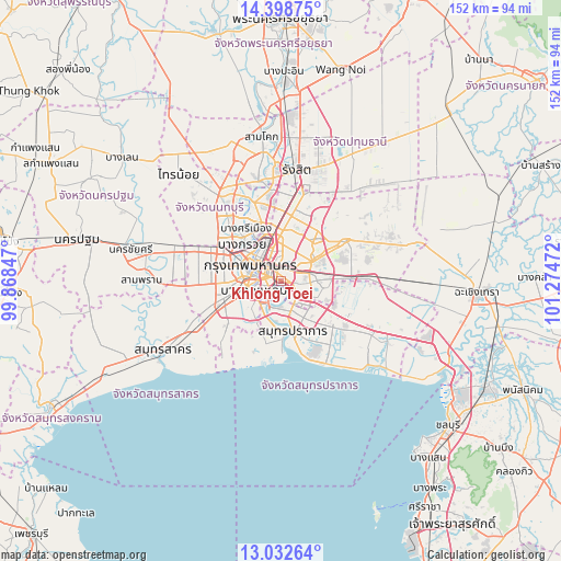
Khlong Toei GPS coordinates[2]
13° 43' 0.084" North, 100° 34' 17.724" East
| Map corner | latitude | longitude |
|---|---|---|
| Upper-left | 14.39875°, | 99.86847° |
| Center: | 13.71669°, | 100.57159° |
| Lower-right: | 13.03264°, | 101.27472° |
| Map W x H: | 151.9×151.9 km | = 94.4×94.4mi |
| max Lat: | 20.43353° ⇑71.3% North |
| Khlong Toei: | 13.71669° |
| min Lat: | ⇓28.7% South 5.77434° |
| min Long | Khlong Toei | max Long |
| 97.93288° | 100.57159° | 105.49506° |
| W 44.9%⇐ | ⇒55.1% E |
Elevation
Elevation of Khlong Toei is 27 m = 89 ft, and this is 98.5 m = 323 ft below average elevation for this country.
| Max E: |
1011 m = 3317 ft | 67.7% |
| Avg. | 125.5 m = 412 ft | |
| Khlong Toei | 27 m = 89 ft | |
Min E: |
1 m = 3 ft | 32.3% |
See also: Thailand elevation on elevation.city.
Geographical zone
Khlong Toei is located in North Torrid zone (between Equator and Tropic of Cancer). Distance of this Northern Tropic circle is 1080.8 km =671.6 mi to North.| Distance of | km | miles | from Khlong Toei |
|---|---|---|---|
| North Pole | 8481.9 | 5270.4 | to North |
| Arctic Circle | 5876 | 3651.2 | to North |
| Tropic Cancer | 1080.8 | 671.6 | to North |
| Equator | 1525.2 | 947.7 | to South |


Nearby cities:
15 places around Khlong Toei: (largest is in red/bold)
• Bang Kho Laem
7.9 km =4.9 mi,  250°
250°
• Bang Rak
5.4 km =3.4 mi,  286°
286°
• Din Daeng
6.3 km =3.9 mi,  341°
341°
• Huai Khwang
6.7 km =4.2 mi,  6°
6°
• Khlong San
6.9 km =4.3 mi,  283°
283°
• Pathum Wan
5.6 km =3.5 mi, 293°
• Phaya Thai
7.7 km =4.8 mi, 336°
• Phra Khanong
3.6 km =2.2 mi,  116°
116°
• Phra Pradaeng
7.7 km =4.8 mi,  212°
212°
• Pom Prap Sattru Phai
7.8 km =4.8 mi,  306°
306°
• Ratchathewi
6.2 km =3.9 mi,  318°
318°
• Samphanthawong
6.4 km =4 mi, 284°
• Sathon
5 km =3.1 mi,  259°
259°
• Watthana
2.1 km =1.3 mi,  45°
45°
• Yan Nawa
3.9 km =2.4 mi,  234°
234°
Sources, notices
• [Note1] Compared only with cities in Thailand existing in our database
• [Src1] Map data: © OpenStreetMap contributors (CC-BY-SA)
• [Src2] Other city data from geonames.org with taken over terms of usage.
• [Src3] Geographical zone / Annual Mean Temperature by Robert A. Rohde @ Wikipedia
