Wiang Chiang Rung geodata
Wiang Chiang Rung (Chiang Rai) is a seat of a second-order administrative division; located in Thailand in Asia/Bangkok (GMT+7) time zone. In our database, there are 331 cities with bigger population. Compared to other cities in Thailand, 99.1% of cities are located further ↓South; 70.9% of cities are located further →East and 94.8% of cities have lower elevation than Wiang Chiang Rung. Note1


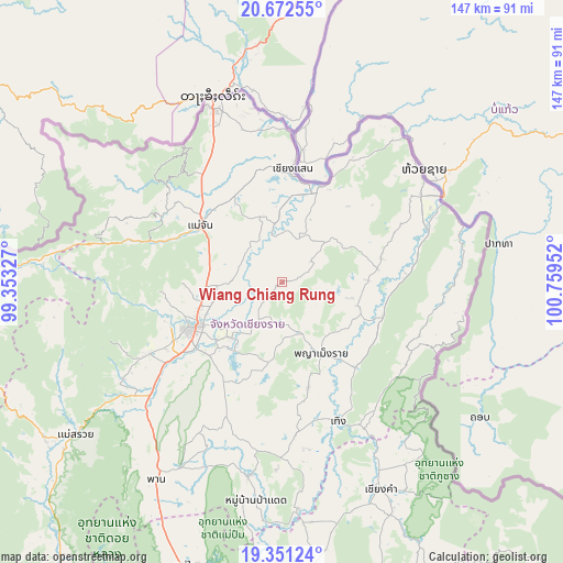
Wiang Chiang Rung GPS coordinates[2]
20° 0' 47.808" North, 100° 3' 23.004" East
| Map corner | latitude | longitude |
|---|---|---|
| Upper-left | 20.67255°, | 99.35327° |
| Center: | 20.01328°, | 100.05639° |
| Lower-right: | 19.35124°, | 100.75952° |
| Map W x H: | 146.9×146.9 km | = 91.3×91.3mi |
| max Lat: | 20.43353° ⇑0.9% North |
| Wiang Chiang Rung: | 20.01328° |
| min Lat: | ⇓99.1% South 5.77434° |
| min Long | Wiang Chiang Ru | max Long |
| 97.93288° | 100.05639° | 105.49506° |
| W 29.1%⇐ | ⇒70.9% E |
Elevation
Elevation of Wiang Chiang Rung is 389 m = 1276 ft, and this is 263.5 m = 865 ft above average elevation for this country.
| Max E: |
1011 m = 3317 ft | 5.2% |
| Wiang Chiang Rung | 389 m 1276 ft | |
| Avg. | 125.5 m = 412 ft | |
Min E: |
1 m = 3 ft | 94.8% |
See also: Thailand elevation on elevation.city.
Geographical zone
Wiang Chiang Rung is located in North Torrid zone (between Equator and Tropic of Cancer). Distance of this Northern Tropic circle is 380.7 km =236.6 mi to North.| Distance of | km | miles | from Wiang Chiang Rung |
|---|---|---|---|
| North Pole | 7781.8 | 4835.4 | to North |
| Arctic Circle | 5175.9 | 3216.2 | to North |
| Tropic Cancer | 380.7 | 236.6 | to North |
| Equator | 2225.3 | 1382.7 | to South |


Nearby cities:
15 places around Wiang Chiang Rung: (largest is in red/bold)
• Ban Ho Mae Salong
47.4 km =29.5 mi,  291°
291°
• Chiang Khong
45.6 km =28.3 mi,  52°
52°
• Chiang Rai
26.1 km =16.2 mi,  243°
243°
• Chiang Saen
29.3 km =18.2 mi,  6°
6°
• Doi Luang
12.5 km =7.8 mi,  21°
21°
• Khun Tan
29.1 km =18.1 mi,  133°
133°
• Mae Chan
25.9 km =16.1 mi,  304°
304°
• Mae Fa Luang
38.9 km =24.2 mi,  316°
316°
• Mae Lao
44.8 km =27.8 mi, 236°
• Mae Sai
50.4 km =31.3 mi,  338°
338°
• Phaya Mengrai
20.9 km =13 mi,  150°
150°
• Phu Sang
53.9 km =33.5 mi, 148°
• Thoeng
39.2 km =24.4 mi,  158°
158°
• Wiang Chai
19.3 km =12 mi,  221°
221°
• Wiang Kaen
49 km =30.4 mi,  76°
76°
Sources, notices
• [Note1] Compared only with cities in Thailand existing in our database
• [Src1] Map data: © OpenStreetMap contributors (CC-BY-SA)
• [Src2] Other city data from geonames.org with taken over terms of usage.
• [Src3] Geographical zone / Annual Mean Temperature by Robert A. Rohde @ Wikipedia
