Khun Tan geodata
Khun Tan (Chiang Rai) is a seat of a second-order administrative division; located in Thailand in Asia/Bangkok (GMT+7) time zone. In our database, there are 331 cities with bigger population. Compared to other cities in Thailand, 98.6% of cities are located further ↓South; 65.8% of cities are located further →East and 94.5% of cities have lower elevation than Khun Tan. Note1


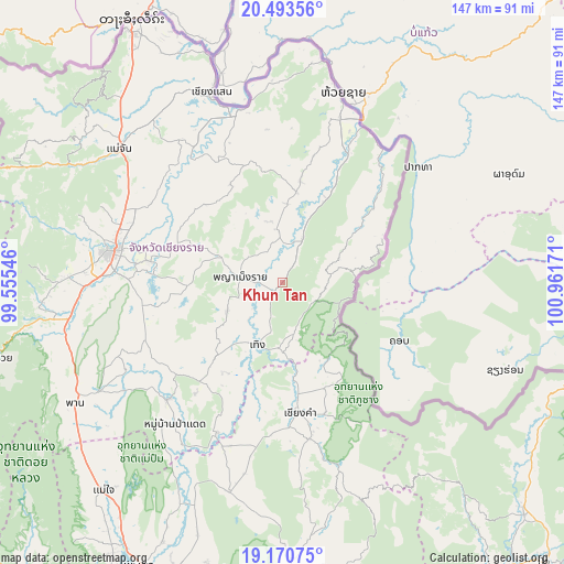
Khun Tan GPS coordinates[2]
19° 50' 0.708" North, 100° 15' 30.888" East
| Map corner | latitude | longitude |
|---|---|---|
| Upper-left | 20.49356°, | 99.55546° |
| Center: | 19.83353°, | 100.25858° |
| Lower-right: | 19.17075°, | 100.96171° |
| Map W x H: | 147.1×147.1 km | = 91.4×91.4mi |
| max Lat: | 20.43353° ⇑1.4% North |
| Khun Tan: | 19.83353° |
| min Lat: | ⇓98.6% South 5.77434° |
| min Long | Khun Tan | max Long |
| 97.93288° | 100.25858° | 105.49506° |
| W 34.2%⇐ | ⇒65.8% E |
Elevation
Elevation of Khun Tan is 382 m = 1253 ft, and this is 256.5 m = 842 ft above average elevation for this country.
| Max E: |
1011 m = 3317 ft | 5.5% |
| Khun Tan | 382 m 1253 ft | |
| Avg. | 125.5 m = 412 ft | |
Min E: |
1 m = 3 ft | 94.5% |
See also: Thailand elevation on elevation.city.
Geographical zone
Khun Tan is located in North Torrid zone (between Equator and Tropic of Cancer). Distance of this Northern Tropic circle is 400.6 km =248.9 mi to North.| Distance of | km | miles | from Khun Tan |
|---|---|---|---|
| North Pole | 7801.8 | 4847.8 | to North |
| Arctic Circle | 5195.9 | 3228.6 | to North |
| Tropic Cancer | 400.6 | 248.9 | to North |
| Equator | 2205.3 | 1370.3 | to South |


Nearby cities:
15 places around Khun Tan: (largest is in red/bold)
• Chiang Kham
34.8 km =21.6 mi,  172°
172°
• Chiang Khong
49.9 km =31 mi,  17°
17°
• Chiang Rai
45.3 km =28.1 mi,  280°
280°
• Chiang Saen
52.3 km =32.5 mi,  339°
339°
• Chun
56.7 km =35.2 mi,  193°
193°
• Doi Luang
35.7 km =22.2 mi,  332°
332°
• Mae Chan
54.9 km =34.1 mi,  309°
309°
• Mae Lao
58.7 km =36.5 mi,  265°
265°
• Pa Daet
46 km =28.6 mi,  217°
217°
• Phaya Mengrai
11.1 km =6.9 mi, 279°
• Phu Sang
27 km =16.8 mi, 165°
• Thoeng
17.8 km =11.1 mi,  202°
202°
• Wiang Chai
34.5 km =21.4 mi, 279°
• Wiang Chiang Rung
29.1 km =18.1 mi, 313°
• Wiang Kaen
40.9 km =25.4 mi,  40°
40°
Sources, notices
• [Note1] Compared only with cities in Thailand existing in our database
• [Src1] Map data: © OpenStreetMap contributors (CC-BY-SA)
• [Src2] Other city data from geonames.org with taken over terms of usage.
• [Src3] Geographical zone / Annual Mean Temperature by Robert A. Rohde @ Wikipedia
