Sam Ko geodata
Sam Ko (Ang Thong) is a seat of a second-order administrative division; located in Thailand in Asia/Bangkok (GMT+7) time zone. In our database, there are 331 cities with bigger population. Compared to other cities in Thailand, 57.6% of cities are located further ↑North; 66.1% of cities are located further →East and 78.4% of cities have higher elevation than Sam Ko. Note1


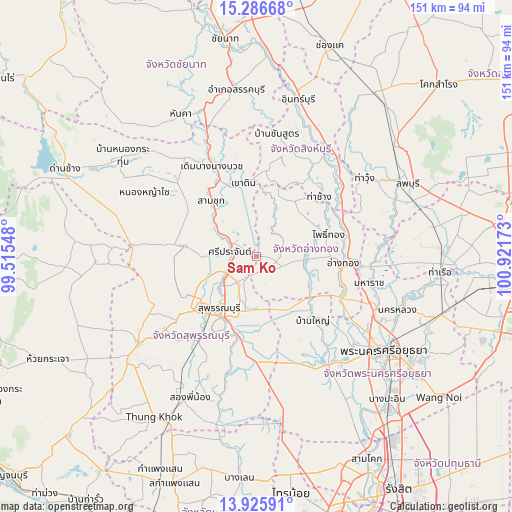
Sam Ko GPS coordinates[2]
14° 36' 26.46" North, 100° 13' 6.96" East
| Map corner | latitude | longitude |
|---|---|---|
| Upper-left | 15.28668°, | 99.51548° |
| Center: | 14.60735°, | 100.2186° |
| Lower-right: | 13.92591°, | 100.92173° |
| Map W x H: | 151.3×151.3 km | = 94×94mi |
| max Lat: | 20.43353° ⇑57.6% North |
| Sam Ko: | 14.60735° |
| min Lat: | ⇓42.4% South 5.77434° |
| min Long | Sam Ko | max Long |
| 97.93288° | 100.2186° | 105.49506° |
| W 33.9%⇐ | ⇒66.1% E |
Elevation
Elevation of Sam Ko is 13 m = 43 ft, and this is 112.5 m = 369 ft below average elevation for this country.
| Max E: |
1011 m = 3317 ft | 78.4% |
| Avg. | 125.5 m = 412 ft | |
| Sam Ko | 13 m = 43 ft | |
Min E: |
1 m = 3 ft | 21.6% |
See also: Thailand elevation on elevation.city.
Geographical zone
Sam Ko is located in North Torrid zone (between Equator and Tropic of Cancer). Distance of this Northern Tropic circle is 981.7 km =610 mi to North.| Distance of | km | miles | from Sam Ko |
|---|---|---|---|
| North Pole | 8382.9 | 5208.9 | to North |
| Arctic Circle | 5777 | 3589.7 | to North |
| Tropic Cancer | 981.7 | 610 | to North |
| Equator | 1624.2 | 1009.2 | to South |


Nearby cities:
15 places around Sam Ko: (largest is in red/bold)
• Ang Thong
25.3 km =15.7 mi,  94°
94°
• Ban Sam Chuk
20 km =12.4 mi,  318°
318°
• Bang Pla Ma
24.4 km =15.2 mi,  195°
195°
• Bang Rachan
23.1 km =14.4 mi,  24°
24°
• Chaiyo
28 km =17.4 mi,  74°
74°
• Don Chedi
21.5 km =13.4 mi,  278°
278°
• Phak Hai
23.3 km =14.5 mi,  135°
135°
• Pho Thong
21.5 km =13.4 mi, 71°
• Sam Chuk
21.7 km =13.5 mi, 320°
• Sawaeng Ha
19.5 km =12.1 mi,  37°
37°
• Sawaengha
19.7 km =12.2 mi, 35°
• Si Prachan
8.1 km =5 mi, 279°
• Suphan Buri
18.1 km =11.2 mi,  215°
215°
• Tha Chang
25.2 km =15.7 mi,  47°
47°
• Wiset Chaichan
13 km =8.1 mi,  96°
96°
Sources, notices
• [Note1] Compared only with cities in Thailand existing in our database
• [Src1] Map data: © OpenStreetMap contributors (CC-BY-SA)
• [Src2] Other city data from geonames.org with taken over terms of usage.
• [Src3] Geographical zone / Annual Mean Temperature by Robert A. Rohde @ Wikipedia
