Mae La Noi geodata
Mae La Noi (Mae Hong Son) is a seat of a second-order administrative division; located in Thailand in Asia/Bangkok (GMT+7) time zone. In our database, there are 331 cities with bigger population. Compared to other cities in Thailand, 92.1% of cities are located further ↓South; 99.8% of cities are located further →East and 92.8% of cities have lower elevation than Mae La Noi. Note1


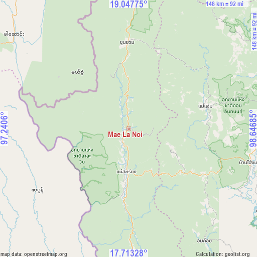
Mae La Noi GPS coordinates[2]
18° 22' 54.516" North, 97° 56' 37.392" East
| Map corner | latitude | longitude |
|---|---|---|
| Upper-left | 19.04775°, | 97.2406° |
| Center: | 18.38181°, | 97.94372° |
| Lower-right: | 17.71328°, | 98.64685° |
| Map W x H: | 148.4×148.4 km | = 92.2×92.2mi |
| max Lat: | 20.43353° ⇑7.9% North |
| Mae La Noi: | 18.38181° |
| min Lat: | ⇓92.1% South 5.77434° |
| min Long | Mae La Noi | max Long |
| 97.93288° | 97.94372° | 105.49506° |
| W 0.2%⇐ | ⇒99.8% E |
Elevation
Elevation of Mae La Noi is 324 m = 1063 ft, and this is 198.5 m = 651 ft above average elevation for this country.
| Max E: |
1011 m = 3317 ft | 7.2% |
| Mae La Noi | 324 m 1063 ft | |
| Avg. | 125.5 m = 412 ft | |
Min E: |
1 m = 3 ft | 92.8% |
See also: Thailand elevation on elevation.city.
Geographical zone
Mae La Noi is located in North Torrid zone (between Equator and Tropic of Cancer). Distance of this Northern Tropic circle is 562.1 km =349.3 mi to North.| Distance of | km | miles | from Mae La Noi |
|---|---|---|---|
| North Pole | 7963.2 | 4948.1 | to North |
| Arctic Circle | 5357.3 | 3328.9 | to North |
| Tropic Cancer | 562.1 | 349.3 | to North |
| Equator | 2043.9 | 1270 | to South |


Nearby cities:
15 places around Mae La Noi: (largest is in red/bold)
• Ban Hong
92.6 km =57.5 mi,  93°
93°
• Ban Huai I Huak
35.1 km =21.8 mi,  164°
164°
• Ban Pa Pae
16.1 km =10 mi,  132°
132°
• Chaem Luang
80.9 km =50.3 mi,  26°
26°
• Chom Thong
77.2 km =48 mi, 87°
• Doi Lo
88.4 km =54.9 mi,  84°
84°
• Doi Tao
91.7 km =57 mi,  121°
121°
• Hot
73.4 km =45.6 mi,  106°
106°
• Khun Yuam
49.8 km =30.9 mi,  358°
358°
• Mae Chaem
46.3 km =28.8 mi,  73°
73°
• Mae Wang
91.2 km =56.7 mi, 73°
• Om Koi
78.1 km =48.5 mi,  145°
145°
• Samoeng
98 km =60.9 mi,  58°
58°
• Sop Moei
46.7 km =29 mi,  181°
181°
• Wiang Nong Long
85.1 km =52.9 mi, 87°
Sources, notices
• [Note1] Compared only with cities in Thailand existing in our database
• [Src1] Map data: © OpenStreetMap contributors (CC-BY-SA)
• [Src2] Other city data from geonames.org with taken over terms of usage.
• [Src3] Geographical zone / Annual Mean Temperature by Robert A. Rohde @ Wikipedia
