Chaem Luang geodata
Chaem Luang (Chiang Mai) is a seat of a second-order administrative division; located in Thailand in Asia/Bangkok (GMT+7) time zone. In our database, there are 331 cities with bigger population. Compared to other cities in Thailand, 95.2% of cities are located further ↓South; 99% of cities are located further →East and 99.9% of cities have lower elevation than Chaem Luang. Note1


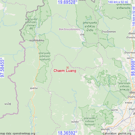
Chaem Luang GPS coordinates[2]
19° 1' 54.948" North, 98° 17' 15.612" East
| Map corner | latitude | longitude |
|---|---|---|
| Upper-left | 19.69528°, | 97.58455° |
| Center: | 19.03193°, | 98.28767° |
| Lower-right: | 18.36592°, | 98.9908° |
| Map W x H: | 147.8×147.8 km | = 91.8×91.8mi |
| max Lat: | 20.43353° ⇑4.8% North |
| Chaem Luang: | 19.03193° |
| min Lat: | ⇓95.2% South 5.77434° |
| min Long | Chaem Luang | max Long |
| 97.93288° | 98.28767° | 105.49506° |
| W 1%⇐ | ⇒99% E |
Elevation
Elevation of Chaem Luang is 940 m = 3084 ft, and this is 814.5 m = 2672 ft above average elevation for this country.
| Max E: |
1011 m = 3317 ft | 0.099999999999994% |
| Chaem Luang | 940 m 3084 ft | |
| Avg. | 125.5 m = 412 ft | |
Min E: |
1 m = 3 ft | 99.9% |
See also: Thailand elevation on elevation.city.
Geographical zone
Chaem Luang is located in North Torrid zone (between Equator and Tropic of Cancer). Distance of this Northern Tropic circle is 489.8 km =304.3 mi to North.| Distance of | km | miles | from Chaem Luang |
|---|---|---|---|
| North Pole | 7890.9 | 4903.2 | to North |
| Arctic Circle | 5285 | 3283.9 | to North |
| Tropic Cancer | 489.8 | 304.3 | to North |
| Equator | 2116.2 | 1314.9 | to South |


Nearby cities:
15 places around Chaem Luang: (largest is in red/bold)
• Chiang Mai
78.1 km =48.5 mi,  110°
110°
• Chom Thong
79.5 km =49.4 mi,  149°
149°
• Hang Dong
76.7 km =47.7 mi,  119°
119°
• Khun Yuam
43.5 km =27 mi,  238°
238°
• Mae Chaem
59.8 km =37.2 mi,  172°
172°
• Mae Hi
38.6 km =24 mi,  26°
26°
• Mae Hong Son
44.9 km =27.9 mi,  311°
311°
• Mae Taeng
69.4 km =43.1 mi,  82°
82°
• Mae Wang
68.9 km =42.8 mi,  132°
132°
• Pai
40 km =24.9 mi,  23°
23°
• Samoeng
51 km =31.7 mi, 113°
• San Pa Tong
78.2 km =48.6 mi, 125°
• Sop Pong
54.2 km =33.7 mi,  356°
356°
• Wiang Haeng
69.2 km =43 mi, 32°
• Wiang Nuea
42.1 km =26.2 mi, 23°
Sources, notices
• [Note1] Compared only with cities in Thailand existing in our database
• [Src1] Map data: © OpenStreetMap contributors (CC-BY-SA)
• [Src2] Other city data from geonames.org with taken over terms of usage.
• [Src3] Geographical zone / Annual Mean Temperature by Robert A. Rohde @ Wikipedia
