Khun Yuam geodata
Khun Yuam (Mae Hong Son) is a seat of a second-order administrative division; located in Thailand in Asia/Bangkok (GMT+7) time zone. In our database, there are 331 cities with bigger population. Compared to other cities in Thailand, 94.6% of cities are located further ↓South; 99.9% of cities are located further →East and 98.9% of cities have lower elevation than Khun Yuam. Note1


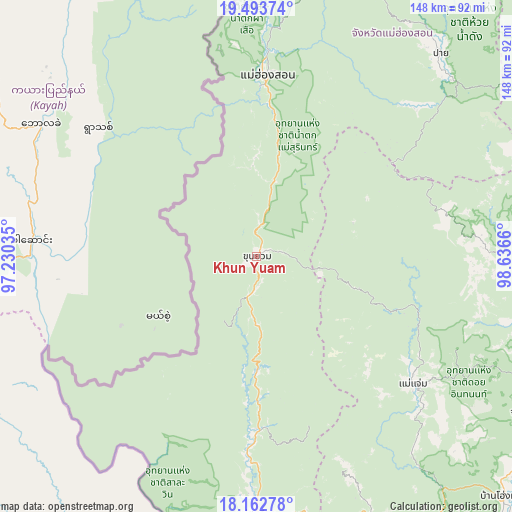
Khun Yuam GPS coordinates[2]
18° 49' 46.488" North, 97° 56' 0.492" East
| Map corner | latitude | longitude |
|---|---|---|
| Upper-left | 19.49374°, | 97.23035° |
| Center: | 18.82958°, | 97.93347° |
| Lower-right: | 18.16278°, | 98.6366° |
| Map W x H: | 148×148 km | = 92×92mi |
| max Lat: | 20.43353° ⇑5.4% North |
| Khun Yuam: | 18.82958° |
| min Lat: | ⇓94.6% South 5.77434° |
| min Long | Khun Yuam | max Long |
| 97.93288° | 97.93347° | 105.49506° |
| W 0.1%⇐ | ⇒99.9% E |
Elevation
Elevation of Khun Yuam is 620 m = 2034 ft, and this is 494.5 m = 1622 ft above average elevation for this country.
| Max E: |
1011 m = 3317 ft | 1.1% |
| Khun Yuam | 620 m 2034 ft | |
| Avg. | 125.5 m = 412 ft | |
Min E: |
1 m = 3 ft | 98.9% |
See also: Thailand elevation on elevation.city.
Geographical zone
Khun Yuam is located in North Torrid zone (between Equator and Tropic of Cancer). Distance of this Northern Tropic circle is 512.3 km =318.3 mi to North.| Distance of | km | miles | from Khun Yuam |
|---|---|---|---|
| North Pole | 7913.4 | 4917.2 | to North |
| Arctic Circle | 5307.5 | 3297.9 | to North |
| Tropic Cancer | 512.3 | 318.3 | to North |
| Equator | 2093.7 | 1301 | to South |


Nearby cities:
15 places around Khun Yuam: (largest is in red/bold)
• Ban Huai I Huak
84.2 km =52.3 mi,  172°
172°
• Ban Pa Pae
62 km =38.5 mi, 167°
• Chaem Luang
43.5 km =27 mi,  58°
58°
• Chom Thong
90.5 km =56.2 mi,  120°
120°
• Mae Chaem
58.4 km =36.3 mi,  128°
128°
• Mae Hi
78.8 km =49 mi,  43°
43°
• Mae Hong Son
52.5 km =32.6 mi,  4°
4°
• Mae La Noi
49.8 km =30.9 mi,  178°
178°
• Mae Wang
91.5 km =56.9 mi,  105°
105°
• Pai
79.6 km =49.5 mi, 41°
• Samoeng
84.1 km =52.3 mi,  88°
88°
• Sop Moei
96.5 km =60 mi, 180°
• Sop Pong
84 km =52.2 mi,  24°
24°
• Wiang Nong Long
97.3 km =60.5 mi, 117°
• Wiang Nuea
81.5 km =50.6 mi, 41°
Sources, notices
• [Note1] Compared only with cities in Thailand existing in our database
• [Src1] Map data: © OpenStreetMap contributors (CC-BY-SA)
• [Src2] Other city data from geonames.org with taken over terms of usage.
• [Src3] Geographical zone / Annual Mean Temperature by Robert A. Rohde @ Wikipedia
