Ban Rai geodata
Ban Rai (Uthai Thani) is a seat of a second-order administrative division; located in Thailand in Asia/Bangkok (GMT+7) time zone. In our database, there are 331 cities with bigger population. Compared to other cities in Thailand, 51.4% of cities are located further ↓South; 84.6% of cities are located further →East and 65.2% of cities have lower elevation than Ban Rai. Note1


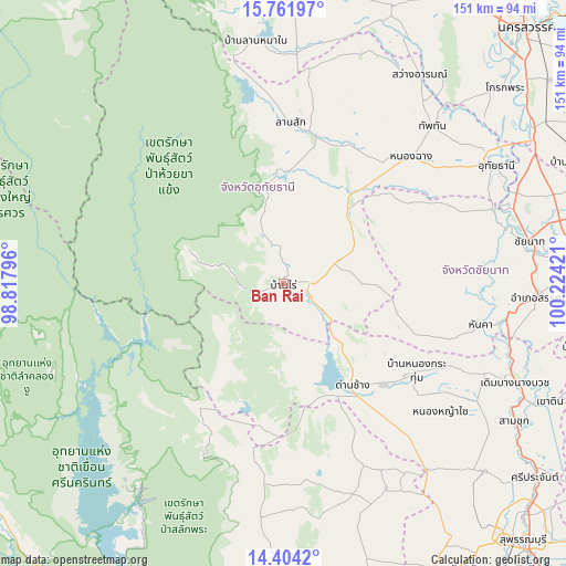
Ban Rai GPS coordinates[2]
15° 5' 3.012" North, 99° 31' 15.888" East
| Map corner | latitude | longitude |
|---|---|---|
| Upper-left | 15.76197°, | 98.81796° |
| Center: | 15.08417°, | 99.52108° |
| Lower-right: | 14.4042°, | 100.22421° |
| Map W x H: | 151×151 km | = 93.8×93.8mi |
| max Lat: | 20.43353° ⇑48.6% North |
| Ban Rai: | 15.08417° |
| min Lat: | ⇓51.4% South 5.77434° |
| min Long | Ban Rai | max Long |
| 97.93288° | 99.52108° | 105.49506° |
| W 15.4%⇐ | ⇒84.6% E |
Elevation
Elevation of Ban Rai is 160 m = 525 ft, and this is 34.5 m = 113 ft above average elevation for this country.
| Max E: |
1011 m = 3317 ft | 34.8% |
| Ban Rai | 160 m 525 ft | |
| Avg. | 125.5 m = 412 ft | |
Min E: |
1 m = 3 ft | 65.2% |
See also: Thailand elevation on elevation.city.
Geographical zone
Ban Rai is located in North Torrid zone (between Equator and Tropic of Cancer). Distance of this Northern Tropic circle is 928.7 km =577.1 mi to North.| Distance of | km | miles | from Ban Rai |
|---|---|---|---|
| North Pole | 8329.9 | 5176 | to North |
| Arctic Circle | 5724 | 3556.7 | to North |
| Tropic Cancer | 928.7 | 577.1 | to North |
| Equator | 1677.2 | 1042.2 | to South |


Nearby cities:
15 places around Ban Rai: (largest is in red/bold)
• Chum Ta Bong
61 km =37.9 mi,  3°
3°
• Dan Chang
32.9 km =20.4 mi,  144°
144°
• Hankha
54.2 km =33.7 mi,  102°
102°
• Huai Khot
25.2 km =15.7 mi,  24°
24°
• Lan Sak
41.4 km =25.7 mi,  8°
8°
• Lao Khwan
60.8 km =37.8 mi,  153°
153°
• Noen Kham
47.3 km =29.4 mi,  108°
108°
• Nong Chang
48.5 km =30.1 mi,  45°
45°
• Nong Kha Yang
53.7 km =33.4 mi, 54°
• Nong Mamong
42.8 km =26.6 mi,  60°
60°
• Nong Prue
53.4 km =33.2 mi,  187°
187°
• Nong Yasai
53.8 km =33.4 mi,  128°
128°
• Thap Than
57.7 km =35.9 mi,  43°
43°
• Uthai Thani
63.2 km =39.3 mi, 58°
• Wat Sing
59.1 km =36.7 mi,  70°
70°
Sources, notices
• [Note1] Compared only with cities in Thailand existing in our database
• [Src1] Map data: © OpenStreetMap contributors (CC-BY-SA)
• [Src2] Other city data from geonames.org with taken over terms of usage.
• [Src3] Geographical zone / Annual Mean Temperature by Robert A. Rohde @ Wikipedia
