Lan Sak geodata
Lan Sak (Uthai Thani) is a seat of a second-order administrative division; located in Thailand in Asia/Bangkok (GMT+7) time zone. With population of 13,905 people, there are 237 cities with bigger population in this country. Compared to other cities in Thailand, 57.6% of cities are located further ↓South; 83.7% of cities are located further →East and 51.3% of cities have lower elevation than Lan Sak. Note1


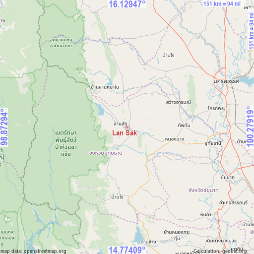
Lan Sak GPS coordinates[2]
15° 27' 10.404" North, 99° 34' 33.816" East
| Map corner | latitude | longitude |
|---|---|---|
| Upper-left | 16.12947°, | 98.87294° |
| Center: | 15.45289°, | 99.57606° |
| Lower-right: | 14.77409°, | 100.27919° |
| Map W x H: | 150.7×150.7 km | = 93.6×93.6mi |
| max Lat: | 20.43353° ⇑42.4% North |
| Lan Sak: | 15.45289° |
| min Lat: | ⇓57.6% South 5.77434° |
| min Long | Lan Sak | max Long |
| 97.93288° | 99.57606° | 105.49506° |
| W 16.3%⇐ | ⇒83.7% E |
Elevation
Elevation of Lan Sak is 112 m = 367 ft, and this is 13.5 m = 44 ft below average elevation for this country.
| Max E: |
1011 m = 3317 ft | 48.7% |
| Avg. | 125.5 m = 412 ft | |
| Lan Sak | 112 m = 367 ft | |
Min E: |
1 m = 3 ft | 51.3% |
See also: Thailand elevation on elevation.city.
Geographical zone
Lan Sak is located in North Torrid zone (between Equator and Tropic of Cancer). Distance of this Northern Tropic circle is 887.7 km =551.6 mi to North.| Distance of | km | miles | from Lan Sak |
|---|---|---|---|
| North Pole | 8288.9 | 5150.5 | to North |
| Arctic Circle | 5683 | 3531.3 | to North |
| Tropic Cancer | 887.7 | 551.6 | to North |
| Equator | 1718.2 | 1067.6 | to South |


Nearby cities:
15 places around Lan Sak: (largest is in red/bold)
• Ban Rai
41.4 km =25.7 mi,  188°
188°
• Chum Ta Bong
20.1 km =12.5 mi,  352°
352°
• Huai Khot
18.5 km =11.5 mi,  166°
166°
• Krok Phra
54.3 km =33.7 mi,  77°
77°
• Lat Yao
40.2 km =25 mi,  34°
34°
• Mae Poen
25.5 km =15.8 mi,  333°
333°
• Mae Wong
37.1 km =23.1 mi, 350°
• Manorom
56.6 km =35.2 mi,  106°
106°
• Nong Chang
29.3 km =18.2 mi,  103°
103°
• Nong Kha Yang
39.1 km =24.3 mi, 104°
• Nong Mamong
36.8 km =22.9 mi,  122°
122°
• Sawang Arom
33.8 km =21 mi,  64°
64°
• Thap Than
33.8 km =21 mi,  88°
88°
• Uthai Thani
48.8 km =30.3 mi, 99°
• Wat Sing
54.2 km =33.7 mi, 113°
Sources, notices
• [Note1] Compared only with cities in Thailand existing in our database
• [Src1] Map data: © OpenStreetMap contributors (CC-BY-SA)
• [Src2] Other city data from geonames.org with taken over terms of usage.
• [Src3] Geographical zone / Annual Mean Temperature by Robert A. Rohde @ Wikipedia
