Nong Prue geodata
Nong Prue (Kanchanaburi) is a seat of a second-order administrative division; located in Thailand in Asia/Bangkok (GMT+7) time zone. In our database, there are 331 cities with bigger population. Compared to other cities in Thailand, 57.5% of cities are located further ↑North; 86.1% of cities are located further →East and 56% of cities have lower elevation than Nong Prue. Note1


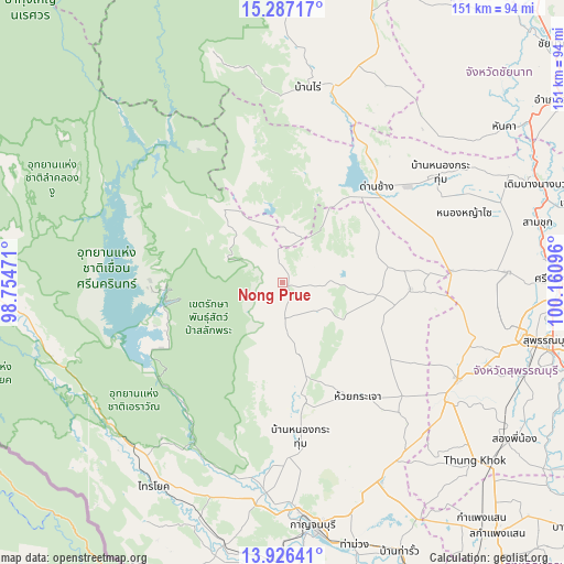
Nong Prue GPS coordinates[2]
14° 36' 28.224" North, 99° 27' 28.188" East
| Map corner | latitude | longitude |
|---|---|---|
| Upper-left | 15.28717°, | 98.75471° |
| Center: | 14.60784°, | 99.45783° |
| Lower-right: | 13.92641°, | 100.16096° |
| Map W x H: | 151.3×151.3 km | = 94×94mi |
| max Lat: | 20.43353° ⇑57.5% North |
| Nong Prue: | 14.60784° |
| min Lat: | ⇓42.5% South 5.77434° |
| min Long | Nong Prue | max Long |
| 97.93288° | 99.45783° | 105.49506° |
| W 13.9%⇐ | ⇒86.1% E |
Elevation
Elevation of Nong Prue is 139 m = 456 ft, and this is 13.5 m = 44 ft above average elevation for this country.
| Max E: |
1011 m = 3317 ft | 44% |
| Nong Prue | 139 m 456 ft | |
| Avg. | 125.5 m = 412 ft | |
Min E: |
1 m = 3 ft | 56% |
See also: Thailand elevation on elevation.city.
Geographical zone
Nong Prue is located in North Torrid zone (between Equator and Tropic of Cancer). Distance of this Northern Tropic circle is 981.7 km =610 mi to North.| Distance of | km | miles | from Nong Prue |
|---|---|---|---|
| North Pole | 8382.8 | 5208.8 | to North |
| Arctic Circle | 5776.9 | 3589.6 | to North |
| Tropic Cancer | 981.7 | 610 | to North |
| Equator | 1624.2 | 1009.2 | to South |


Nearby cities:
15 places around Nong Prue: (largest is in red/bold)
• Ban Rai
53.4 km =33.2 mi,  7°
7°
• Ban Sam Chuk
70.2 km =43.6 mi,  77°
77°
• Bo Phloi
32 km =19.9 mi,  168°
168°
• Dan Chang
36.6 km =22.7 mi,  44°
44°
• Don Chedi
60.7 km =37.7 mi,  87°
87°
• Huai Krachao
38.5 km =23.9 mi,  144°
144°
• Kanchanaburi
67.8 km =42.1 mi, 171°
• Lao Khwan
34.1 km =21.2 mi, 92°
• Noen Kham
64.2 km =39.9 mi,  53°
53°
• Nong Yasai
52.3 km =32.5 mi,  68°
68°
• Phanom Thuan
59.1 km =36.7 mi,  153°
153°
• Sai Yok
64.1 km =39.8 mi,  212°
212°
• Sam Chuk
70 km =43.5 mi, 76°
• Si Sawat
37 km =23 mi,  268°
268°
• U Thong
53.4 km =33.2 mi,  118°
118°
Sources, notices
• [Note1] Compared only with cities in Thailand existing in our database
• [Src1] Map data: © OpenStreetMap contributors (CC-BY-SA)
• [Src2] Other city data from geonames.org with taken over terms of usage.
• [Src3] Geographical zone / Annual Mean Temperature by Robert A. Rohde @ Wikipedia
