Ban Phru Nai geodata
Ban Phru Nai (Phangnga) is a populated place; located in Thailand in Asia/Bangkok (GMT+7) time zone. With population of 5,713 people, there are 307 cities with bigger population in this country. Compared to other cities in Thailand, 89.8% of cities are located further ↑North; 95.8% of cities are located further →East and 68.1% of cities have higher elevation than Ban Phru Nai. Note1


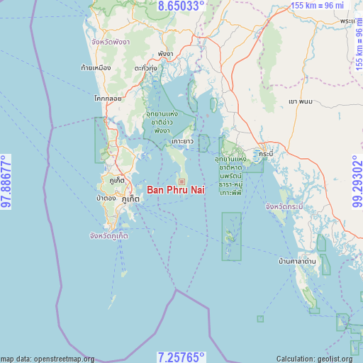
Ban Phru Nai GPS coordinates[2]
7° 57' 16.488" North, 98° 35' 23.604" East
| Map corner | latitude | longitude |
|---|---|---|
| Upper-left | 8.65033°, | 97.88677° |
| Center: | 7.95458°, | 98.58989° |
| Lower-right: | 7.25765°, | 99.29302° |
| Map W x H: | 154.9×154.9 km | = 96.3×96.3mi |
| max Lat: | 20.43353° ⇑89.8% North |
| Ban Phru Nai: | 7.95458° |
| min Lat: | ⇓10.2% South 5.77434° |
| min Long | Ban Phru Nai | max Long |
| 97.93288° | 98.58989° | 105.49506° |
| W 4.2%⇐ | ⇒95.8% E |
Elevation
Elevation of Ban Phru Nai is 26 m = 85 ft, and this is 99.5 m = 326 ft below average elevation for this country.
| Max E: |
1011 m = 3317 ft | 68.1% |
| Avg. | 125.5 m = 412 ft | |
| Ban Phru Nai | 26 m = 85 ft | |
Min E: |
1 m = 3 ft | 31.9% |
See also: Thailand elevation on elevation.city.
Geographical zone
Ban Phru Nai is located in North Torrid zone (between Equator and Tropic of Cancer). Distance of Equator is 884.5 km =549.6 mi to South.| Distance of | km | miles | from Ban Phru Nai |
|---|---|---|---|
| North Pole | 9122.6 | 5668.5 | to North |
| Arctic Circle | 6516.7 | 4049.3 | to North |
| Tropic Cancer | 1721.5 | 1069.7 | to North |
| Equator | 884.5 | 549.6 | to South |


Nearby cities:
15 places around Ban Phru Nai: (largest is in red/bold)
• Ban Ao Nang
26.3 km =16.3 mi,  67°
67°
• Ban Chalong
30.2 km =18.8 mi,  246°
246°
• Ban Karon
34.2 km =21.3 mi, 249°
• Ban Ko Kaeo
21.4 km =13.3 mi,  264°
264°
• Ban Ratsada
21.2 km =13.2 mi, 256°
• Ban Talat Nua
23.8 km =14.8 mi, 250°
• Ban Talat Yai
22.3 km =13.9 mi, 249°
• Kathu
28.6 km =17.8 mi, 261°
• Ko Yao
17.3 km =10.7 mi,  0°
0°
• Mueang Phuket
26.8 km =16.7 mi, 247°
• Patong
32.9 km =20.4 mi, 258°
• Phi Phi Don
31.1 km =19.3 mi,  139°
139°
• Phuket
22.3 km =13.9 mi, 251°
• Thalang
29.4 km =18.3 mi,  286°
286°
• Wichit
23.7 km =14.7 mi, 252°
Sources, notices
• [Note1] Compared only with cities in Thailand existing in our database
• [Src1] Map data: © OpenStreetMap contributors (CC-BY-SA)
• [Src2] Other city data from geonames.org with taken over terms of usage.
• [Src3] Geographical zone / Annual Mean Temperature by Robert A. Rohde @ Wikipedia
